Rif
mountains, Morocco
also called Rif Mountains, Arabic Al-Rif
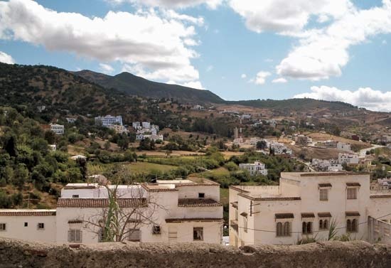 mountain range of northern Morocco, extending from Tangier to the Moulouya River valley near the Moroccan-Algerian frontier. For the greater part of its 180-mile (290-km) length, the range hugs the Mediterranean Sea, leaving only a few narrow coastal valleys suitable for agriculture or urban settlement. The higher peaks, including Mount Tidirhine, which at 8,059 feet (2,456 metres) is the loftiest, are snowcapped in winter. Although the mountains are highly mineralized, only iron ore is mined on a large scale. Attracted to the region's ruggedness and remoteness, Amazigh ( Berber) tribes led by Abd el-Krim (1882–1963) resisted Franco-Spanish occupation there in the 1920s. Since Moroccan independence in 1956, communications across the Rif have been improved with a summit road and the Route de l'Unité (from Fès to Kétama).
people
also spelled Riff, or Riffi
any of the Berber peoples occupying a part of northeastern Morocco known as the Rif, an Arabic word meaning “edge of cultivated area.” The Rif are divided into 19 groups or social units: 5 in the west along the Mediterranean coast, 7 in the centre, 5 in the east, and 2 in the southeastern desert area. One central group is Arabic-speaking, as are sections of the five western groups. The others generally speak Rif, a regionally variable Berber language, but many also speak Spanish or Arabic. The Rif are Muslims.
The land of the Rif is a combination of mountains, rolling fields, and deserts, bordered by two rivers and 145 miles (233 km) of coastline. Their material culture is based on cultivation, herding, and sardine-seining.
Before their loss of independence in 1926 (see Rif War), the Rif were organized by kinship and residence into graded units. Each unit elected or appointed a council of men who were renowned fighters.
- Sir C Wyville Thomson
- Sir Cyril Burt
- Sir Cyril Norman Hinshelwood
- Sir Daniel, 1st Baronet Gooch
- Sir Daniel Gooch, 1st Baronet
- Sir D'Arcy Wentworth Thompson
- Sir David Attenborough
- Sir David Brewster
- Sir David Gill
- Sir David Hare
- Sir David Lean
- Sir David Low
- Sir David Lyndsay
- Sir David Macpherson
- Sir David Ross
- Sir David Stirling
- Sir David Wilkie
- Sir Dawda Kairaba Jawara
- Sir Denis Hamilton
- Sir Dennis Holme Robertson
- Sir Derek H.R. Barton
- Sir Derek Jacobi
- Sir Desmond MacCarthy
- Sir Dominic John, Baronet Corrigan
- Sir Dominic John Corrigan, Baronet