Papua New Guinea
Introduction
officially Independent State of Papua New Guinea,
Papua New Guinea, flag ofisland country in the southwestern Pacific Ocean. It encompasses the eastern half of the island of New Guinea (the western half, Irian Jaya, belonging to Indonesia) and its offshore islands as well as the islands of the Bismarck Archipelago (New Britain, New Ireland, and the Admiralty Islands) and those of Bougainville and Buka. These islands stretch from just south of the Equator to the Torres Strait, which separates New Guinea from Cape York Peninsula, the northernmost extension of Australia.
The official languages of the country are all introduced: English, Tok Pisin (Melanesian Pidgin), and Hiri, or Police, Motu, the last being a simplified form of the language of the people who lived around what is now the capital, Port Moresby, when it was first established in 1884. The islands that constitute Papua New Guinea have been settled for tens of thousands of years by the mixture of peoples who are generally referred to as Melanesians, and one of the principal challenges facing those who govern the modern state is the difficulty of welding together hundreds of diverse, once-isolated regional societies into a viable modern nation-state.
The land
Relief
 Papua New Guinea's (Papua New Guinea) magnificent and varied scenery reflects a generally recent geologic history in which movements of the Earth's crust resulted in the collision of the northward-moving Australian Plate with the westward-moving Pacific Plate. The low-lying plains of southern New Guinea are geologically part of the Australian Plate. Indeed, New Guinea was separated physically from Australia only 8,000 years ago by the shallow flooding of the Torres Strait. The southern New Guinea plains, called the Fly-Digul shelf after the Fly and Digul rivers, are geologically stable but very sparsely populated by seminomadic sago gatherers.
Northward lies a belt of limestone country of varying width, most prominent in the Kikori River–Lake Kutubu area. This forms an extraordinarily harsh environment of jumbled karst, dolines, rock towers, and seemingly endless ridges of jagged rock, all covered in virtually impenetrable lowland rain forest. The discovery of mineral deposits about 1970 stimulated mining activity in the previously deserted region.
 Farther to the north lie the Highlands, an east–west-trending zone of mountains with elevations in excess of 13,000 feet (4,000 metres) and enclosed upland basins whose floors are usually at 4,500 feet or higher. The basins contain lake deposits, formed in the recent geologic past by impeded drainage; soil wash from the surrounding mountains; and layers of volcanic ash, or tephra, deposited from nearby and recently active volcanoes. Such basins, therefore, are usually very fertile. Temperatures are much cooler than in the lowlands, and frosts occasionally cause serious damage to the sweet potato (kaukau), which is the staple diet of the area. Much of the natural vegetation of most of the upland basins has been removed by the intensive agricultural technology of the Highlanders. Throughout the Highlands, carefully tended gridiron gardens with their drainage ditches or perfectly circular earth-covered mounds of compost dominate the landscape.
The mountains drop away sharply to the north, and the intensive cultivation of fertile soils gives way to swidden (slash-and-burn, or shifting) cultivation of taro and yams in the forests of the foothills. These thinly populated areas in turn give way to the sago swamps along the courses of the great Ramu and Sepik rivers (Sepik River), the latter area famous for its magnificent folk art but equally noted for its immense numbers of mosquitoes. In the slightly more elevated areas away from the main rivers, the high water table combines with the human activities of swidden cultivation and hunting (the burning of vegetation to drive animals toward hunters) to create extensive areas of poor grassland.
The most northerly zone consists of a complex, unstable volcanic arc stretching from the Schouten Islands off Wewak to the Huon Peninsula and through New Britain island, at which point it bifurcates, one arm sweeping northwestward through New Ireland and the Admiralty Islands, the other proceeding southeastward through Bougainville and the Solomon Islands. The north coast, unlike the swampy south coast, drops sharply to the sea, and stands of mangrove and, in brackish waters, nipa palm are rather limited. This northern volcanic fringe contains some of the most fertile soils of the islands. Thus, despite the hazards of volcanic activity and frequent earth tremors, the area is generally well-populated. The island of Karkar and the Gazelle Peninsula of New Britain island are centres of particularly dense population where yams, taro, bananas, and fish are the basic foods. Elsewhere, previously little-used volcanic soils are the focus of large-scale resettlement and oil-palm-cropping schemes, especially in western New Britain.
Drainage
Steeply sloping mountain areas, exceptionally heavy rainfall, geologic instability in all except the most southerly areas, and rapid growth of both population and commercial enterprise combine to create some of the highest soil-erosion rates in the world, rivaling those of the Himalaya region. Consequently, while rivers are usually quite short in length, they carry extraordinarily high sediment loads, which have built up vast swampy plains and deltas, especially along the Sepik, the Fly, and the Purari river systems. Once they leave the Highlands, often through spectacular gorges, such rivers meander slowly across the sediment plains. For example, 512 miles (824 kilometres) from its mouth the Fly River is a mere 60 feet above sea level. Such high deposition rates create major problems for any proposed human use of these rivers, for transportation or hydroelectricity generation, for example.
Climate
Although all the climatic regions of Papua New Guinea are basically tropical, they are nevertheless varied. In the lowlands, mean annual maximum temperatures range between 86° and 90° F (30° and 32° C), and the minimums are between 73° and 75° F (23° and 24° C). Seasonal variation in temperature is slight, and the daily variation approximates the annual variation. Cooler conditions prevail in the Highlands, where night frosts are common above 6,500 feet; daytime temperatures there generally exceed 72° F (22° C) regardless of season.
Rainfall, rather than temperature, is the determinant of season. Precipitation is dependent on two wind systems, the southeast trades and the northwesterly turbulence zone (the monsoon), and on the three site characteristics of latitude, altitude, and exposure. The southeasterlies blow for approximately seven months (May to November) on the extreme southeast of the country (Milne Bay) and for gradually shorter periods northward, predominating for only three months in the Admiralty Islands. Conversely, northwesterlies are more common on the north coast and in the Bismarck Archipelago, but they affect Port Moresby for only three to four months of the year (December through March). The Highlands seem to have their own airflow systems, receiving rain throughout the year totaling between 100 and 160 inches (2,500 and 4,000 millimetres). With the northwesterlies, rain is frequently from convectional storms, and rain shadow effects are reduced. With the southeasterlies, however, exposure is particularly important. The Port Moresby coastal area is parched throughout the period of the southeasterlies, which flow parallel to the coast, yet where mountainous land lies athwart the airflow, as in New Britain or the southward-facing slopes of the Highlands, rainfall is extremely heavy, frequently exceeding 300 inches. Port Moresby receives less than 50 inches of rain annually, which occasions problems of water and hydroelectric power supply.
Plant and animal life
In most areas the coastline is lined by mangrove swamp, succeeded inland by nipa palm (Nipa fruticans) in brackish waters. Farther inland, particularly along the valleys of the larger rivers in the north and along the deltas of the south coast, large stands of sago palm are scattered. Primary lowland rain forest covers much of the island up to approximately 3,300 feet above sea level. The forest is characterized by a large number of species, by the absence of pure stands of any one species, by fairly distinct layering of the forest into two or three levels, by the limited development of undergrowth, and by the small amount of human impact upon it. Dense undergrowth is usually a sign of human interference, except on soils that are particularly poor or where the low height of the forest allows sunlight to penetrate to the soil surface. In those lowland areas where drier conditions prevail, agriculture and hunting have often changed the delicately balanced natural ecosystem into grassland (for example, in the Sepik and Markham river valleys).
In the uplands above 3,300 feet, stands of single species become more common, and trees such as oak, beech, red cedar, and pine become increasingly dominant. Above 6,500 feet, cloud or moss forest characterized by conifers, tree ferns, and a wealth of fungi and epiphytes (such as mosses and orchids) appears.
Papua New Guinea possesses a rich variety of reptiles, marsupials (animals that carry their young in pouches), native freshwater fish, and birds but is almost devoid of large mammals. Since the Tertiary Period (which occurred from 66,400,000 to 1,600,000 years ago), the island has been isolated from Southeast Asia by the sea, and its animals thereafter evolved in isolation. This appears not to have been true for plant life, for New Guinea has been a centre of dispersal for many plants to all neighbouring regions. The extraordinary profusion in Papua New Guinea of such plants as orchids, figs (Ficus), and false beech (Nothofagus) and of such animals as cassowaries (large, flightless birds), birds of paradise, parrots, butterflies, and marsupials—including the tree kangaroo and phalanger—gives the island an unparalleled biogeography.
Papua New Guinea's unique biological species have long been sought by collectors all over the world. The government has introduced several conservation and protection measures; the export of birds of paradise is now banned, and hunters thereof are restricted to the use of traditional weapons. Similarly, the export of many other birds and butterflies and of crocodile skins is strictly regulated. Other policies encourage the controlled expansion of selected exports of “farmed” orchids and crocodiles and of “cultivated” butterflies and other insects.
Settlement patterns
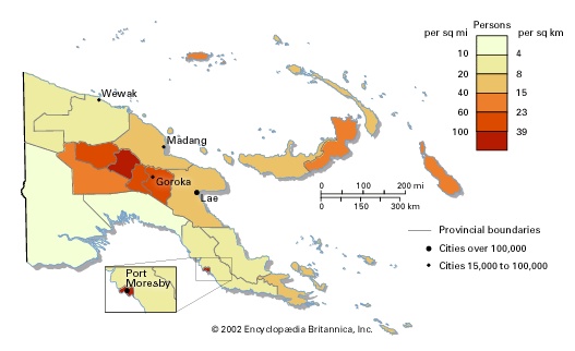
More than 80 percent of the country's population lives in rural areas. Rural settlement patterns are extremely varied. In isolated areas of the southern interior there still remains a handful of the previously common giant communal structures that house the whole male population, with a circling cluster of women's huts. In many coastal areas, villages stretch between the beach and an inland swamp in long lines, broken into clan or family segments. In the Highlands numerous village forms exist: in the Eastern Highlands and Chimbu provinces, villages previously clustered along ridgetops for defensive purposes are dispersing increasingly downslope; in the Western Highlands and Enga provinces, the traditional form is of scattered households each surrounded by its own land, with separate houses for men and women; in the Telefomin area, clustered villages are supplemented by scattered garden houses at a distance from the central settlement. Housing styles originally reflected environmental circumstances, ranging from houses built over the sea in sheltered coastal areas, which avoided mosquitoes and simplified sanitary disposal problems, to houses dug into the ground to retain heat in the colder parts of the Highlands. Such adjustments are disappearing as Western-style housing becomes more common.
The 14 percent of the population that is urban lives in towns whose original location was determined either by access to a good harbour for early colonial planters or, in the interior, by the sufficient availability of level land for an airstrip. Despite the greatly diminished importance of plantations and the removal out of town of most of the airstrips, these origins help determine the existing urban layout. Within the towns, of which Port Moresby and Lae are the largest, there are great contrasts in housing. Port Moresby has, for example, grand modern apartment blocks overlooking the sea, but nearly half its population lives in squatter settlements. Rapid urban growth, at about 6 percent annually, and considerable income inequalities mean that public or low-cost housing cannot be built in sufficient quantities to accommodate much more than a relatively small portion of the urban population.
The people
Ethnic composition
 Papua New Guinea's (Papua New Guinea) ethnic composition is extremely complex. There are more than 700 ethnic groups; these are often separated into two major divisions, Papuan (constituting more than four-fifths of the total population) and Melanesian (Melanesian culture) (constituting all but about 1 percent of the rest of the population). Very small minorities of chiefly Micronesian and chiefly Polynesian ethnic groups can be found on some of the outlying islands. Within the larger divisions, characteristics vary widely; the Melanesians, for example, who generally inhabit the coastal regions and offshore islands, range from the relatively tall, light-skinned Trobriand Islanders to the black-skinned people of Buka. Ethnic Papuans, who live mainly in the interior, are often physically characterized by other citizens as stocky and muscular.
While at independence in 1975 the expatriate community of 40,000 was predominantly of Australian and Chinese origin, a decade later the slightly smaller foreign community was more mixed, with the largest non-Western group being from the Philippines.
Linguistic composition
There are two radically different indigenous language types—Austronesian, or Melanesian, and non-Austronesian (Austronesian languages), or Papuan (Papuan languages)—and the language areas generally reflect ethnic divisions. Some 200 related Austronesian languages occur, mainly in the islands and along the New Guinea coast. The approximately 550 non-Austronesian languages have small speech communities, the largest being the Enga, in the Wabag area. Because of the multiplicity of tongues, Tok Pisin has developed as an effective lingua franca.
Religious composition
About three-fifths of the populace consider themselves Protestant, and the largest portion of these are Lutheran. Nearly a third are Roman Catholic. The remainder include Anglicans and Bahāʾīs. Despite the numbers enrolled in introduced religions, traditional religious beliefs persist, and rituals of magic, spells, and sorcery are still widely practiced.
Demographic trends
Population growth is high, about 2.7 percent annually, and two-fifths of the population is under 15 years of age. Since employment in the commercial sector has grown much more slowly (it declined in the 1980s), the government has attempted to concentrate its policies on rural, village-based development in an attempt to reduce urban migration and demands for formal employment. In the early 1980s the birth rate, though falling, was 50 percent higher than the world average, while the death rate was only 25 percent higher and falling much faster. Consequently, full employment is likely to remain a problem.
The economy
Resources
From 1970 onward, major mineral discoveries have transformed the Papua New Guinean economy from one dependent on tropical crops (coffee, copra, cacao) to one that depends for much of its exports on minerals. Large gold or gold and copper deposits have led to major development at Panguna on Bougainville, Ok Tedi in the Star Mountains, Misima Island in Milne Bay, Porgera in the Western Highlands, and Lihir Island near New Ireland. After 70 years of exploration, major natural gas and oil finds were made in the late 1980s; at the end of the decade plans for their exploitation were being prepared.
Such resource exploitation has caused local groups to contest, principally with the national government, the distribution of mineral revenues. Open warfare broke out on Bougainville (Bougainville Island), and the island's gold and copper mine was closed in 1989. Despite this, revenues from mining provided one-fifth of government revenue during the 1980s.
Forestry exploitation, extensive particularly around Madang, in the northeast, and on New Britain and New Ireland islands, accounted for some 10 percent of exports. While fisheries have great potential, this industry has been especially erratic.
Agriculture
Most agricultural production is for subsistence, and production remains difficult to estimate. Almost all commercial crop production is exported. High-quality Arabica coffee is grown throughout the Highlands, while cacao is grown in the islands, oil palms in western New Britain and the southeastern mainland, and robusta coffee on the north coast; copra is produced in all lowland areas, together with some rubber. Production of all crops has been stagnant since 1985. However, after 1975, smallholder growers increasingly took over the bulk of production, replacing plantations.
Industry
Industrial output is of little significance, accounting for only one-tenth of gross domestic product despite the government's attempts to promote its expansion. Processing and manufacturing are centred chiefly in Lae and Port Moresby; products include food, beverages, tobacco goods, wood products, textiles, and metal goods.
Finance
The kina, Papua New Guinea's currency, remained stable and very strong following independence, although problems on Bougainville in 1989 resulted in its devaluation. Responsible financial management remains a strong feature of the Papua New Guinean economy. Foreign investment and taxes thereon have dominated the economy and government receipts since independence.
Trade
Papua New Guinea's trade is roughly in balance. Its exports, principally gold and copper, go primarily to Japan and Europe. Australia has consistently supplied just under half of the country's imports since independence. After machinery and transport equipment, foodstuffs are a major import; the basic diet of most urban dwellers consists of rice and canned fish or meat, very little of which is produced within the country.
Transportation
Despite the construction of the Okuk Highway, which links Lae to all major Highland towns, air transport remains the most important and, from Port Moresby, essentially the only form of interurban transportation. Papua New Guinea has more regularly operative airstrips per 1,000 population than almost any other country in the world. International air access is via Jackson's Airport, Port Moresby.
Administration and social conditions
Papua New Guinea is a member of the Commonwealth, with the British monarch as its head of state. The government follows a unicameral parliamentary system. The head of state appoints the prime minister, who presides over the National Executive Council; the governor-general, who is nominated by the council and represents the crown; and the chief justice, who presides over the six- to eight-member Supreme Court. Political parties are extraordinarily divisive and numerous and have weak local organization. A feature of parliamentary politics in Papua New Guinea during the 1980s was the frequency of motions of no confidence in the government (allowed every six months under the 1975 constitution). Despite the frequent changes of government, policies have remained notably stable. Papua New Guinea's major foreign policy concerns are its bridging role between Southeast Asia and the rest of the Pacific and its relations with Indonesia, which have been occasionally strained as a result of events in neighbouring Irian Jaya. A feature of Papua New Guinea's political life has been its active and free press staffed almost exclusively by national journalists.
Education
Despite Papua New Guinea's impressive progress in education, three-fifths of all adults are illiterate. Only about two-thirds of all children attend primary school, only half of those attending finish primary school, and only one in six primary-school students receives any secondary schooling. The rapid growth and extreme youthfulness of the population (42 percent are under 15 years of age) mean that educational demand outstrips supply even though education is a major item of government expenditure. Families opt to educate sons rather than daughters: for every 10 boys in primary schools, there are 8 girls; at secondary school the figure is 6 girls, and at university 2 girls.
Health and welfare
The village and the family in Papua New Guinea provide largely those welfare services which, in more developed countries, are assumed by the state. Health expenditure in Papua New Guinea as a proportion of total government spending is relatively high for a developing country. Pneumonia and malaria are among the leading causes of mortality. Emphasis on primary health care at the village level has reduced maternal and infant mortality. It has also led to a rapid increase in life expectancy.
Cultural life
Despite incorporation into the modern world, Papua New Guinea retains a rich variety of village cultures, expressed in its human-molded landscapes and its sculpture, painting, storytelling, dance, and body decoration. The Papua New Guinea National Museum and Art Gallery at Waigani has a significant collection of ethnographic artifacts, and the government encourages the continuation and, in some cases, the revival of activities associated with traditional cultures. In 2008 the Kuk Early Agricultural area was designated a UNESCO World Heritage site. Because the area's land has been worked continuously for over 7,000 years, it contains evidence for the beginning of organized agriculture.
History
The peopling of New Guinea
Relatively little archaeological work has been carried out in New Guinea. On the basis of current evidence, it has been postulated that parts of New Guinea were occupied as early as 50,000 years ago. Remains of swamp-drainage channels and other water-management works indicate the existence of intensive agriculture on the island around 7000 BC. The intensity and length of time of human occupation of the Highlands are evidenced by the extent of man-made landscapes in the region. These discoveries are made even more interesting by the fact that the sweet potato, the present staple crop of the region, does not seem to have arrived in the area from the Americas until 300 or 400 years ago. It is presumed that taro was the earlier staple, as it still is in some isolated Highlands basins such as that at Telefomin.
The colonial period
Malay and possibly Chinese traders took spoils and slaves from New Guinea for hundreds of years. The first European visitor may have been Jorge de Meneses, who possibly landed on the island in 1526–27 while en route to the Moluccas. The first European attempt at colonization was made in 1793 by Lieutenant John Hayes, a British naval officer, near Manokwari, now in Irian Jaya. The Dutch, however, claimed the western half of the island as part of the Dutch East Indies in 1828; their control remained nominal until 1898, when their first permanent administrative posts were set up at Fakfak and Manokwari. Captain John Moresby of Great Britain surveyed the southeastern coast in the 1870s, and European planters had moved onto New Britain and New Ireland by the 1880s. By 1884 the southeastern quadrant of New Guinea had been established as a British (British Empire) protectorate, and in the same year the German New Guinea Company began its administration of the northeastern quadrant. Despite early gold finds in British New Guinea (after 1906 administered by Australia as Papua), it was in German New Guinea, administered by the German imperial government after 1899, that most early economic activity took place. Plantations were widely established in the islands and around Madang; labourers were brought from the Sepik River, the Markham Valley, and Buka Island.
German New Guinea was taken over by Australia as a mandated territory of the League of Nations in 1921, after World War I. It remained administratively separate from Papua, where the protectionist policies of Sir Hubert Murray (lieutenant governor of Papua, 1908–40) did little to encourage colonial investment. The discovery in the 1920s of massive gold deposits at the Bulolo River and Edie Creek in the mandated territory increased the disparity of colonial impact in the different regions. In the early 1930s an even greater discovery was made—nearly 1,000,000 people previously unknown to Europeans were contacted in the Highlands basins of the Australian mandate. At first, the Highlanders were utilized as a massive new source of labour for the coastal plantations, a role they continue to play. At the end of World War II, however, the growing of Arabica coffee by small landholders spread rapidly throughout much of the Highlands. Cacao also was rapidly adopted as a plantation and smallholder crop in the islands and around Madang.
In 1945 Australia combined its administration of Papua and that of the mandate into the Territory of Papua and New Guinea, with the common capital at Port Moresby, on the south coast of Papua. From 1946 Australia administered the mandate of New Guinea as a United Nations trust territory. Despite the general lack of economic development in Papua, its one large town of Port Moresby grew rapidly and attracted large numbers of migrants, particularly from the poorer areas.
Independence
Self-government was achieved on Dec. 1, 1973, and full independence from Australia on Sept. 16, 1975. At independence there were attempts in both Bougainville and Papua to secede from the new state. The crisis on Bougainville was subdued as a result of the introduction of provincial government and a devolution of some national powers to such governments. The Papuan movement was also pacified by this action, but it, too, lacked cohesive support. In late 1988 secessionism was rekindled on Bougainville (Bougainville Island) as a result of disputes over the distribution of mineral revenues, and in 1990 Bougainville declared independence, though its independence was not recognized by any country.
Additional Reading
A general guidebook is Andrew Burke et al., Papua New Guinea and Solomon Islands, 7th ed. (2005). H.C. Brookfield, Melanesia: A Geographical Interpretation of an Island World (1971), is a comparative survey of geography. Many aspects of European exploration are included in James Sinclair, Kiap: Australia's Patrol Officers in Papua New Guinea (1981). Essential historical coverage is provided in J.L. Whittaker et al. (eds.), Documents and Readings in New Guinea History: Pre-History to 1889 (1975). The Melanesians' view of change is discussed in Gernot Fugmann (ed.), Ethics and Development in Papua New Guinea (1986). Among the best anthropological works are Lawrence S. Grossman, Peasants, Subsistence Ecology, and Development in the Highlands of Papua New Guinea (1984); Roy A. Rappaport, Pigs for the Ancestors: Ritual in the Ecology of a New Guinea People, new ed. (1984); and Marilyn Strathern, Women in Between: Female Roles in a Male World, Mount Hagen, New Guinea, new ed. (1993).
- Baron Porter of Luddenham Porter, Sir George
- Baron Ramsey Of Canterbury Ramsey, Michael
- Baron Rank, J Arthur Rank
- Baron Riquet de Bonrepos, Pierre-Paul
- Baron Robbins, Lionel Charles Robbins
- Baron Russell, Charles Russell
- Baron, Salo Wittmayer
- Baron Seymour, Thomas Seymour
- Baron Shinwell of Easington Shinwell, Emanuel
- Baron Somers, John Somers
- Baron Stokes, Donald Gresham Stokes
- Baron Strathnairn Of Strathnairn And Of Jhānsi Rose, Hugh Henry
- Barons' War
- Baron Sydenham, Charles Poulett Thomson
- Baron Tanaka Giichi
- Baron Todd, Alexander Robertus Todd
- baron van Coehoorn, Menno
- baron van der Capellen, Godert Alexander Gerard Philip
- Baron van Hoëvell, Wolter Robert
- baron van Imhoff, Gustaaf Willem
- Baron Vansittart, Robert Gilbert Vansittart
- Baron von Beck, Max Wladimir
- baron von der Goltz, Colmar
- Baron von Eötvös, Roland
- Baron von Görtz, Georg Heinrich