Indiana
Pennsylvania, United States
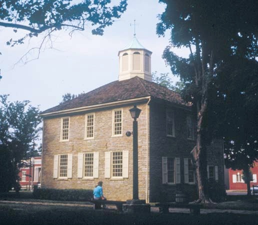
borough (town), seat of Indiana county, west-central Pennsylvania, U.S., in the foothills of the Allegheny Mountains, 46 miles (74 km) northeast of Pittsburgh. Settled about 1764, it was laid out in 1805 on land donated for a county seat by George Clymer of Philadelphia, a signer of the U.S. Declaration of Independence (Declaration of Independence). It was incorporated in 1816. Prior to the American Civil War, Indiana was a station on the Underground Railroad, an escape route for slaves. Indiana University of Pennsylvania was founded there as a teachers college in 1875. The borough is now a centre of retail trade and tourism; the surrounding area produces bituminous coal and a large annual crop of Christmas trees. The Jimmy Stewart (Stewart, James) Museum honours the life and career of the actor who was born in the borough. Pop. (1990) 15,174; (2000) 14,895.
county, Pennsylvania, United States
county, west-central Pennsylvania, U.S., bounded to the south by the Conemaugh River. It consists of a hilly region on the Allegheny Plateau that rises to the Allegheny Mountains in the southeast and is drained by Crooked, Yellow, Two Lick, Blacklick, and Little Mahoning creeks. Other waterways include Yellow Creek Lake, which is surrounded by Yellow Creek State Park.
Indiana county was created in 1803 and named for Indiana Territory (now the state of Indiana). The borough of Indiana is the seat of the county and of Indiana University of Pennsylvania, which was founded in 1875 as Indiana State Normal School. County residents are employed in retail trade, services, manufacturing, and bituminous coal mining. Area 829 square miles (2,148 square km). Pop. (2000) 89,605; (2007 est.) 87,690.
state, United States
Introduction
Indiana, flag of

 constituent state of the United States of America. The state sits, as its motto claims, at “the crossroads of America.” It borders Lake Michigan (Michigan, Lake) and the state of Michigan to the north, Ohio to the east, Kentucky to the south, and Illinois to the west, making it an integral part of the American Midwest (Middle West). Except for Hawaii, Indiana is the smallest state west of the Appalachian Mountains. With a name that is generally thought to mean “land of the Indians,” Indiana was admitted on Dec. 11, 1816, as the 19th state of the union. Its capital has been at Indianapolis since 1825.
constituent state of the United States of America. The state sits, as its motto claims, at “the crossroads of America.” It borders Lake Michigan (Michigan, Lake) and the state of Michigan to the north, Ohio to the east, Kentucky to the south, and Illinois to the west, making it an integral part of the American Midwest (Middle West). Except for Hawaii, Indiana is the smallest state west of the Appalachian Mountains. With a name that is generally thought to mean “land of the Indians,” Indiana was admitted on Dec. 11, 1816, as the 19th state of the union. Its capital has been at Indianapolis since 1825.Today Indiana's economy is based primarily on services, manufacturing, and, to a much lesser extent, agriculture. Its northern areas lie in the mainstream of the industrial belt that extends from Pennsylvania and New York to Illinois. Agricultural activity is heaviest in the central region, which is situated in the Corn Belt, which stretches from Ohio to Nebraska.
Although Indiana is historically part of the North (North, the), many parts of the state display a character that is much like that of the South (South, the). This is largely a reflection of the early settlement of the region by migrants from the South, who brought with them a hearty distrust of the federal government. Many of Indiana's people take pride in a self-image derived largely from 19th-century America that values hard work, is oriented to the small town and medium-sized city, and is interested in maintaining the prerogatives of local self-determination. It is not by coincidence that the Indianan's nickname, Hoosier, remains a symbol in the country's lore for a kind of homespun wisdom, wit, and folksiness that harks back to what is popularly regarded as a less-hurried and less-complicated period of history.
The cities near the state's northwestern corner form an industrial, economic, and social continuum with neighbouring Chicago. Their significant African American and Hispanic populations and the political aspirations contrast strikingly with life in the smaller cities and towns near the state's southern boundary. Thus, Indiana's population is to some extent black and Hispanic in the urban north and mostly white in the less industrialized south. Though generally considered a conservative and Republican (Republican Party) stronghold, Indiana has voted into both state and national office nearly as many Democrats (Democratic Party) as Republicans. Area 36,418 square miles (94,322 square km). Pop. (2000) 6,080,485; (2007 est.) 6,345,289.
Land (Indiana)
Relief, drainage, and soils

 Indiana forms part of the east-central lowlands that slope downward from the Appalachian Mountains to the Mississippi River. Most of the state's surface was modified by glacial (glacier) action, leaving a vast quantity of excellent soil material and extensive deposits of sand, gravel, glacial till, and loess. The more-eroded southern part of the state gives way to the central plain, an extremely fertile agricultural belt with large farms, and then to the mostly flat glacial lake basin and moraine (rocky glacial debris) region of northern Indiana. The highest elevation is near the Ohio border, at about 1,250 feet (380 metres) above sea level, while the lowest point, at roughly 330 feet (100 metres), is in the southwest where the Wabash River enters the Ohio River. About 90 percent of the land lies between 500 and 1,000 feet (150 and 300 metres).
 The general slope and drainage pattern is toward the south and southwest, though an almost imperceptible groundswell in the northeast forms a watershed between the St. Lawrence (Saint Lawrence River and Seaway) and Mississippi basins. The Wabash, the Ohio, and the east and west forks of the White River form part of the Mississippi basin. In the north the St. Joseph River (Saint Joseph River) meanders into Lake Michigan, while in the east the Maumee (Maumee River) flows northeastward into Lake Erie (Erie, Lake). The northern half of the state is dotted with many small glacial lakes, including several of the state's largest.
A high percentage of the forested land is privately owned, primarily by farmers. Among the dramatic features of the landscape are the Indiana Dunes—sand dunes (sand dune) along Lake Michigan—most of which have been removed from the public domain by industry and private homes. This situation was remedied somewhat with the dedication in 1972 of Indiana Dunes National Lakeshore. One of the most scenic parts of the state is the hilly south-central region around Brown County.
Climate
Indiana has four distinct seasons and a temperate climate, usually escaping extremes of cold and heat. In January, daily temperatures in Jeffersonville, on the Ohio River in the south, usually rise from the low 20s F (about –6 °C) into the low 40s F (about 4 °C), while in South Bend, near Lake Michigan in the north, temperatures typically range from the mid-10s F (about −9 °C) to the low 30s F (about −1 °C). In July, temperatures in both the north and the south normally drop into the mid-60s F (about 17 °C) and rise into the mid- to upper 80s F (28–32 °C) daily.
Annual precipitation varies from about 45 inches (1,150 mm) in the south-central region to about 37 inches (940 mm) in the north. Snow may fall over a six-month period and averages more than 20 inches (510 mm) annually, with the cities along the northern border often reporting more than 100 inches (2,540 mm). The climate of northwestern Indiana is modified greatly by its presence in the lee of Lake Michigan (Michigan, Lake). Cold air passing over the warmer lake water in fall (October through December) and winter (January through March) induces heavy precipitation, and winter snowfall especially is several times greater than in other parts of the state. In addition, average daily temperatures are warmer in the fall and cooler in the spring (April through June) as a result of this “lake effect.” Indiana is part of a belt of Midwestern states with an unusually high frequency of severe storms. Spring, with its generally erratic and unstable weather, is the season with the greatest number of tornadoes (tornado).
Plant and animal life
In the early 19th century Indiana was almost entirely covered with the deciduous hardwood forests common to the eastern United States. The nonforested portion of the state, primarily in the northwestern corner, consisted of grasslands—an extension into Indiana of the central Great Plains. Steady growth of agriculture, urban areas, and industry and the consequent pollution have taken a toll on natural life, however. Pollution of both air and water has been particularly severe near the industrial areas along the southern tip of Lake Michigan.
Most of Indiana's forests are secondary growth and contain a wide spectrum of trees, including various types of hickories, sycamores, maples, and oaks, which together offer a spectacular display of color in fall. Flowering trees, such as tulip trees (Liriodendron tulipifera; also called yellow poplars) and dogwoods, illuminate the forests in spring. Several species of ferns also are found in the state's woodlands. Many species of herbaceous plants cover the state's prairie region, with goldenrod, bluestem grasses, and various European introductions among the most common.
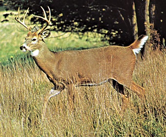 Indiana is home to many sorts of animals commonly found in the eastern United States. Aside from white-tailed deer, the population of which has been revived largely as a result of government conservation efforts, smaller mammals such as opossums, skunks, raccoons, rabbits, moles, shrews, and bats are abundant throughout the state. Rodents of various sorts are plentiful; they include woodchucks, squirrels, rats, mice, and, in the wetlands of the northeast and southwest, beavers and muskrats. Swans, geese, ducks, and other water birds—including the endangered sandhill crane—also inhabit the state's wetlands. Minnows, catfish, trout, perch, sunfish, and bass are among Indiana's common freshwater fish. Several rare types of fish, including the lake sturgeon, are found in Indiana's waters as well.
People (Indiana)
Population composition
Hoosiers are predominantly white, native-born Americans of native-born parents, most of whom trace their ancestry ultimately to Germany, England, Scotland, and Ireland. Significant concentrations of ethnic minorities, however, are found in the larger metropolitan areas. People of African descent, who constitute roughly one-tenth of the state's total population, are concentrated primarily in the urban areas. They account for more than four-fifths of the population of Gary, more than one-third of the residents of East Chicago, and about one-fourth of the population of Indianapolis. People of German descent make up a significant portion of the large white population in South Bend, and, along with those of Polish, Hungarian, Belgian, and Italian ancestry, they are numerous throughout the north. A significant and growing Hispanic population lives primarily in the cities of central and northern Indiana. In the early 21st century Asians continued to constitute a small fraction of the population, but their numbers were increasing rapidly.
More than two-thirds of the people of Indiana who are part of an organized religion are Protestant (Protestant Heritage). Roman Catholics (Roman Catholicism), who make up a sizable percentage of the population of southeastern and northern Indiana, are concentrated largely in the urban areas with large continental European and Irish ethnic groups, particularly South Bend. Jews (Jew) account for a tiny percentage of the state's population and live almost exclusively in urban centres. The Amish people constitute a small group located mostly in the northeast, in and around Middlebury, Nappanee, and Goshen, where Mennonites (Mennonite) also live, but there is also a notable Amish community in Daviess county in the southwest.
Settlement patterns and demographic trends
Indiana was one of the first states to be surveyed using the township and range system established by Congress in 1785. As a general rule, migrants from New England, New York, and Ohio settled in the townships of the northern tier of Indiana's counties; people from the Middle Atlantic states and again from Ohio settled central Indiana; and people from the Southern states, especially Kentucky and Tennessee, settled southern Indiana. From its early years, then, the state has reflected the larger cultural regions of the eastern United States.
From an occupational perspective, there are three major regions of settlement in Indiana. The first of these is the northern region of industry and truck farming. In this area, the nighttime skies of northwestern Indiana are illuminated by its steel furnaces, and during the daytime lingering clouds of industrial smoke often shadow such cities as Gary and Hammond. Southward to the Wabash valley are rich farmlands, obtained largely by draining and clearing marshes. South Bend is an important manufacturing city and a noted educational centre in the north-central region. The northeastern part of the state is more forested and pastoral, although Elkhart and Fort Wayne are major industrial centres.
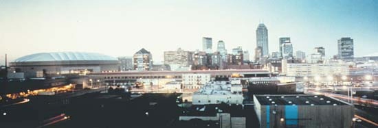 The fertile plains of the central agricultural zone form the second occupational region of Indiana. Indianapolis, a city designed after Versailles, France, and Washington, D.C. (Washington), dominates the area; much of its growth has occurred through immigration from rural areas and annexation. A railway and highway hub, Indianapolis serves the surrounding farming belt as a distribution centre. It also is a major industrial city.
The third region is one of mining, quarrying, and agriculture, and it spans much of the southern portion of the state. That area dominated Indiana's early economy, which was dependent on the river traffic of the Ohio and Wabash. That dominance ended, however, with the advent of industry and railroads. The region's major city, Evansville, continues to serve adjacent areas of Kentucky and Illinois, and between it and Terre Haute to the north lie most of the state's oil and coal deposits. Southward from Bloomington is a vast limestone belt underlain by numerous caves, which makes the state a major limestone producer.
In the early 21st century more than three-fourths of the state's residents lived in urban areas, and of these city dwellers more than one-third were concentrated in the Indianapolis metropolitan area alone. Another large segment of the population lived in the urban complex consisting of Gary, Hammond, and East Chicago. The national pattern of relocation from the central city to the suburbs has generally been evident throughout the state, with South Bend, for example, losing residents while the population of its surrounding county has grown.
Economy
For much of the 20th century, Indiana's economy was dominated by manufacturing. The availability of labour and essential materials, the state's location within 800 miles (1,280 km) of most of the country's largest consumer and industrial markets, and the extensive interstate highway infrastructure all contributed to the growth of manufacturing in Indiana. Heavy industrialization, however, has made the state's economy vulnerable to recession, and Indiana has had its share of labour strife, especially in the steel industry. By the early 21st century, manufacturing had begun to give way to services as the largest sector of the economy, and the biological sciences had become a principal focus of the state's economic development efforts.
Agriculture
Along with forestry and fisheries, agriculture employs just a tiny segment of the labour force and generates a similarly small portion of the state's gross product. Nevertheless, technological advances have meant that, despite drops in total farm acreage and number of farms, production has increased. The state is among the country's top producers of corn (maize), soybeans, and mint. Tomatoes are the principal vegetable crop, but watermelons are important in the lower Wabash valley. The state also is one of the leading producers of hogs and dairy products. Other important livestock includes turkeys, ducks, and sheep.
Resources and power
Indiana is a major producer of building stone, quarried around Bedford and Bloomington in the southwest-central part of the state. Although bituminous coal from the southwest is a significant source of energy for the generation of electricity, supplies are able to meet only about half of the state's demand. To fulfill the remaining need, coal is imported from other states. Natural gas, brought in by pipelines, emerged as an important secondary source of energy in the early 21st century, though during the 1880s Indiana's “Gas Belt,” stretching from east-central Indiana south to the Ohio River, was the world's largest producing field. Few attempts were made to conserve the gas, however, and by 1898 the supply was virtually exhausted.
Manufacturing
Manufacturing showed steady growth from the mid-19th to the late 20th century, during which time it emerged as a primary source of income for the state. By the early 21st century growth had slowed somewhat, but the sector still accounted for more than one-fourth of Indiana's gross state product and employed a significant segment of the workforce. The steel and automotive industries, operating primarily out of the northwest, are the major components of the sector. The state also is a leading producer of pharmaceuticals, hardwood furniture, electrical products, caskets, and mobile homes. Elkhart, in the northeast, is well known for its production of musical (wind) instruments. Indianapolis, with a more diverse manufacturing base, is the state's largest manufacturing city. Overall, Indiana ranks among the country's top states in manufacturing.
Services
In the early 21st century the services sector, including trade, had clearly arisen as the largest segment of Indiana's economy, in terms of both income and employment. Real estate, insurance and financial services, health and community services, and wholesale and retail trade—the principal activities within the sector—together constituted roughly one-third of the state's gross product. Professional and technical services were expanding rapidly.
Transportation
Signs on the Indiana Toll Road proclaim the state to be the “Main Street of the Midwest,” perhaps a fair estimate of its central position in interstate transportation, whether by highway, waterway, air, or rail. Indianapolis is served by many major highways, and some of the country's largest moving companies have their headquarters there. Responsibility for road construction and maintenance rests mainly with city, county, state, and federal governments. Indiana ranks high nationally in road mileage per square mile of area, and almost all its rural roads are paved. Virtually all intrastate passengers and much commercial produce travel by road.
Since the late 19th century, Indiana has figured prominently in U.S. railroad history. The American Railway Union, the country's first industrial (as distinct from craft) union, was founded in Terre Haute in 1893 by Eugene V. Debs (Debs, Eugene V.), five-time Socialist candidate for president. The following year it was involved in the Pullman Strike, which advocated a countrywide boycott of Pullman railroad cars and ultimately brought the intervention of federal troops and Debs's imprisonment.
Indiana has a dense network of railroad trackage, compared with most other states. Many freight lines running east from Chicago and St. Louis (Saint Louis), Mo., pass through Indiana. As in other states, however, the Amtrak national passenger rail system that went into operation in 1971 had sharply reduced its service by the early 21st century.
In the southern part of the state, great amounts of freight are transported along the Ohio River, which is Indiana's link to the Mississippi River system. In the north, the Port of Indiana harbour, on Lake Michigan (Michigan, Lake) about 10 miles (16 km) east of Gary, is Indiana's gateway to the St. Lawrence Seaway (Saint Lawrence River and Seaway). It was created artificially and opened in 1970.
Commercial air service is available in major cities. International airports are located at Indianapolis, Gary, Fort Wayne, and Terre Haute. There also are hundreds of smaller public and private airports scattered across the state.
Government and society
Constitutional framework
 As delineated in Indiana's constitution of 1851, which has been amended a number of times since its promulgation, Indiana's government (like that of most other states) is divided into executive, legislative, and judicial branches. However, while the chief executive—the governor—has veto power over legislation, the veto can be overridden by a simple majority of the two houses. The authority of Indiana's governor is wielded largely through executive power to appoint and remove heads of nearly all departments, commissions, and governing boards of institutions. The governor is elected for a four-year period and can serve no more than two terms in a 12-year period. Thus, gubernatorial influence on the legislature—the General Assembly—is often weak during the second half of an administration.
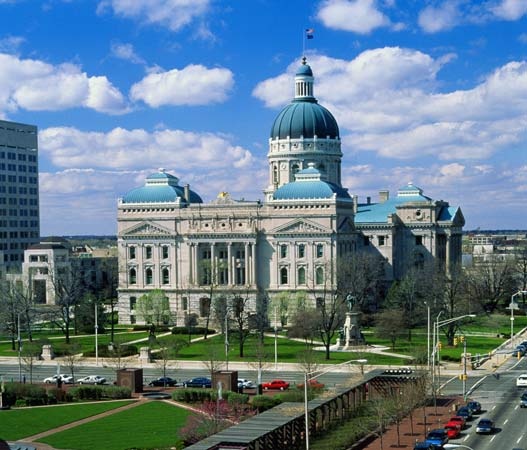 The General Assembly is bicameral, consisting of the Senate as its upper house and the House of Representatives as its lower house. The assembly includes no more than 50 senators, serving four-year terms, and no more than 100 representatives, serving for two years. They may be reelected, but there is often a high turnover. In 1970 the voters approved annual sessions for the two bodies. The state constitution requires that the legislature reapportion itself according to population every six years. This law was ignored, however, from 1923 to 1963, during which time the rural areas exerted an influence far out of proportion to their declining population. Under pressure from the U.S. Supreme Court (Supreme Court of the United States), the state eventually achieved a reapportionment based on the “one man, one vote” principle in 1965.
Indiana's judiciary is headed by the state Supreme Court. Although the Supreme Court has long had just five judges, the state constitution allows for as many as nine. The justices are appointed by the governor and a judicial nominating commission after a screening procedure. A new judge serves for two years and then, if retained, for a term of 10 years. The Court of Appeals consists of as many geographic divisions as is deemed necessary by the General Assembly; in the early 21st century that number was five. Each division has three appellate judges. There are also circuit, superior, municipal, and county courts.
The four principal levels of local government are the county, township, city or town, and school district. Townships can serve a dual capacity as school and civil townships, but overall their importance has been greatly reduced; welfare is now the primary function of townships. Boards of county commissioners have executive and legislative powers, while county councils are concerned almost exclusively with fiscal affairs. City voters elect a mayor and common council.
Indiana is a two-party state, the Republicans having held a slight advantage since the last quarter of the 19th century, especially in the General Assembly and in presidential voting. At the national level the state can claim one president, Benjamin Harrison (Harrison, Benjamin), the grandson of William Henry Harrison (Harrison, William Henry), and five vice presidents. In 1940 the Indiana native son Wendell L. Willkie (Willkie, Wendell L.) was the Republican candidate for president. In presidential elections the state has tilted heavily toward the Republican Party. In 2008, however, after having won the state in every presidential election since 1968, the Republicans lost Indiana to the Democratic candidate.
Health and welfare
In the early 21st century, Indiana ranked relatively high nationally in the amount of assistance granted to public hospitals. Public welfare programs, however, were not as strongly supported. Indeed, the state ranks notably below the national average in per capita expenditure for public welfare and number of recipients of general assistance.
Education
The state's educational system is headed by a board of education and a superintendent of public instruction. Compared with other states, Indiana ranks about average in outlay per pupil, although it spends a significant portion of its general revenue on education. The academic standards of the state's elementary and secondary schools are among the top in the country, but in terms of overall student achievement at these grade levels the schools rank about average. Indiana also ranks about average in its overall high school graduation rate.
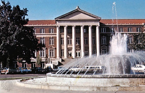
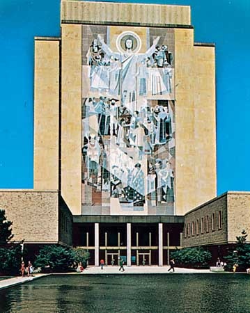 Although in the early 21st century Indiana still had one of the lowest percentages of residents with at least a bachelor's degree, the state had nevertheless made notable achievements in higher education. The three leading universities of the state are Indiana University, in Bloomington; Purdue University, in West Lafayette; and the University of Notre Dame (Notre Dame, University of), near South Bend. Indiana University, founded in 1820, has become noted for its work in several fields, including English, foreign languages, biology, medicine, and law. The university's School of Music is internationally recognized; among the most prominent of its performance series are works staged annually by the Opera Theater. Purdue University, established in 1869 as a land-grant college, is one of the country's leading engineering and agricultural schools. The University of Notre Dame, dating from 1842, is widely regarded as the leading Roman Catholic university of the United States. The institution has a strong graduate faculty, and it also has long excelled in athletics. Originally a men's school, Notre Dame in 1972 began enrolling women from St. Mary's College, also located near South Bend.
Other prominent institutions include the Mennonite liberal arts institution Goshen College, established in 1894, and Valparaiso University, founded in 1879, which is associated with the Lutheran church. In addition to Indiana University, notable public universities include Indiana State University, created by law in Terre Haute in 1865, and Indiana University–Purdue University Indianapolis (IUPUI), which is Indiana's major urban university campus. IUPUI was founded in 1969 as a collaboration between Indiana and Purdue universities; the institution is managed by Indiana University. IUPUI began to show especially rapid growth in the 1980s, and by the early 21st century it had become one of the state's largest universities in terms of student enrollment.
Cultural life
The arts
The visual, performing, and literary arts flourish in most of Indiana's major cities and even in some of the smaller towns. Indianapolis is home to the Indianapolis Museum of Art, the origin of which dates to the late 19th century; the Civic Theater, which is among the country's largest and oldest continuously operating community theatres; and the Indianapolis Symphony Orchestra (founded in 1930), which has a respected place among the country's orchestras. South Bend and Fort Wayne also have symphony orchestras. The town of Nashville, in Brown county, is home to one of the best-known art colonies in the United States. Brown county also is known for its old-time fiddle and bluegrass music (bluegrass); the Bill Monroe Memorial Bluegrass Festival, inaugurated in 1967 by bluegrass founder Bill Monroe (Monroe, Bill), is held annually in the town of Bean Blossom.

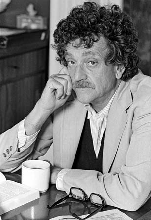 In the realm of the verbal arts, Hoosiers have written some of the country's most popular songs. Notable figures include Hoagy Carmichael (Carmichael, Hoagy) (“Star Dust”), Cole Porter (Porter, Cole) (“Begin the Beguine”), J. Russel Robinson (“Margie”), Albert von Tilzer (“Take Me Out to the Ball Game”), and Paul Dresser (“On the Banks of the Wabash, Far Away”), brother of the novelist Theodore Dreiser (Dreiser, Theodore). Indiana has contributed to popular literature in the United States through such wordsmiths as poet James Whitcomb Riley (Riley, James Whitcomb); novelists Booth Tarkington (Tarkington, Booth), Lew Wallace (Wallace, Lewis), and Kurt Vonnegut, Jr. (Vonnegut, Kurt, Jr.); satirist George Ade (Ade, George); and the World War II chronicler of the foot soldier, Ernie Pyle (Pyle, Ernie). The state also has produced some notable comedians, including Herb Shriner and Red Skelton (Skelton, Red).
Cultural institutions
In addition to its arts institutions, Indiana maintains some unique cultural and historic sites. The Amish conduct a model farm at Amish Acres in Nappanee. Many handsome examples of pre-Civil War architecture are found in the towns along the Ohio (Ohio River) and Wabash (Wabash River) rivers. An old buffalo path used by pioneers moving from Kentucky to the western prairies leads from New Albany, across the Ohio from Louisville, Ky., to the Wabash at Vincennes. The Scottish Rite Cathedral, in Indianapolis, is the largest building dedicated to Freemasonry in the country.
Sports and recreation
 While other states might quibble with Indiana's claim to be the most basketball-crazy state in the country, the game is undeniably a way of life for many Indianans, and almost every citizen seems to participate in Hoosier Hysteria, the state's annual high-school tournament. The Indiana Basketball Hall of Fame in New Castle celebrates this rich tradition and pays homage to a long list of outstanding players and coaches, the most prominent of whom include John Wooden (Wooden, John), Oscar Robertson (Robertson, Oscar), and Larry Bird (Bird, Larry). From Valparaiso (Valparaiso University) and Indiana State (Indiana State University) universities to Purdue University and the University of Notre Dame (Notre Dame, University of), the state's collegiate basketball teams have experienced great success, but none so much as Indiana University, which was guided to three National Collegiate Athletic Association (NCAA) championships by coach Bob Knight (Knight, Bob) in the 1970s and '80s. Indiana University also has enjoyed a history in swimming that has included renowned coach James (“Doc”) Counsilman and Olympians such as Mark Spitz (Spitz, Mark). Indiana and Purdue are members of the Big Ten Conference, and their gridiron football teams meet each year to compete for the Old Oaken Bucket trophy. It is Notre Dame, however, that has produced a host of great football players and coaches, including Knute Rockne (Rockne, Knute), George Gipp (Gipp, George), Paul Hornung, and Joe Montana (Montana, Joe). The nearby city of South Bend, moreover, is the home of the College Football Hall of Fame.
 Indianapolis is internationally known for the Indianapolis (Indy) 500 (Indianapolis 500), an auto race held annually on the Sunday before Memorial Day (the last Monday in May). The first race was held in 1911, while the city was still an automobile-manufacturing centre. The entire month of May has since become devoted to the race. Harness (horse) racing (harness racing), which takes place in and near Indianapolis, is another important component of the sports lore of Indiana.
Indianapolis is the home of several professional teams: the Colts of the National Football League, the Pacers of the National Basketball Association (NBA), and the Fever of the Women's NBA. Minor league baseball has had a presence in the city dating back to the turn of the 20th century. In 1987 the city became the second in the U.S. to host the Pan American Sports Games. The NCAA moved its national headquarters to Indianapolis in 2000 and opened the NCAA Hall of Champions there the same year.
Ed.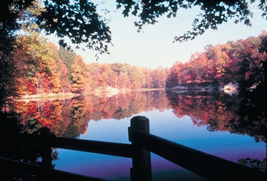
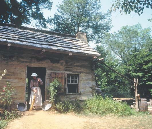 Hoosiers fond of the outdoors enjoy the state parks and forests, as well as the many reservoirs, nature preserves, and wildlife areas. Indiana's largest state park is in Brown county. The state has numerous museums and historic sites, including the Levi Coffin House, a stop on the Underground Railroad, in Fountain City; the Whitewater Canal, with a covered aqueduct, in Metamora; and the Lincoln Boyhood National Memorial, site of Abraham Lincoln's (Lincoln, Abraham) boyhood home, near Dale.
Hoosiers fond of the outdoors enjoy the state parks and forests, as well as the many reservoirs, nature preserves, and wildlife areas. Indiana's largest state park is in Brown county. The state has numerous museums and historic sites, including the Levi Coffin House, a stop on the Underground Railroad, in Fountain City; the Whitewater Canal, with a covered aqueduct, in Metamora; and the Lincoln Boyhood National Memorial, site of Abraham Lincoln's (Lincoln, Abraham) boyhood home, near Dale.Media and publishing
Dozens of daily newspapers are printed and circulate in Indiana. The Indianapolis Star has one of largest readerships in the country. Indiana University's press is an especially respected publisher of academic books, particularly in the arts.
History (Indiana)
Prehistory and exploration
Archaeologists discovered the remains of some of Indiana's earliest known inhabitants at Angel Mounds, an archaeological site on the Ohio River near Evansville. Historical records show that in the early 17th century the indigenous (Native American) Algonquin peoples organized the tribes of the area into the Miami Confederation, which fought to protect the lands from the unfriendly Iroquois. The most powerful tribes in the confederation were the Miami (specifically the Wea and Piankashaw bands) and the Potawatomi. Later that century, the Delaware began to move into the White River region (in response to encroachment by European settlers and the Iroquois) from the Ohio country to the east.
 In 1679 French explorer René-Robert Cavelier, sieur (lord) de La Salle (La Salle, René-Robert Cavelier, sieur (lord) de), traveled by boat from Michigan down the St. Joseph River (Saint Joseph River) into what is now northern Indiana. To the south, traders from North Carolina, South Carolina, and Pennsylvania settled on the Ohio (Ohio River) and the Wabash River shores. The southern settlements threatened the French traders, to whom these rivers and regions were a channel to the Mississippi (Mississippi River)—a means of connecting Canada and Louisiana. To protect their route to the Mississippi, the French built Fort-Miami (1704), near present-day Fort Wayne; Fort-Ouiatanon (1719), near what is now Lafayette; and Fort-Vincennes (1732), one of the first permanent white settlements west of the Appalachians (Appalachian Mountains), at Vincennes.
In 1763 the area was ceded to England, which forbade further white settlement. The prohibition was largely ignored, and in 1774 Parliament annexed the lands to Quebec. During the American Revolution (1775–83) Virginia, Connecticut, and Massachusetts made claims on the land, and in 1779 George Rogers Clark (Clark, George Rogers) secured the area for the rebelling colonies by leading his troops on a surprise march from Kaskaskia to Vincennes.
Territorial period
In 1783 lands lying west of Pennsylvania, north of the Ohio River, east of the Mississippi River, and south of the Great Lakes were ceded to the United States by the Peace of Paris (Paris, Peace of) treaties, which ended the American Revolution. In 1784 the first U.S. settlement was established at Clarksville, on the northern bank of the Ohio River. Through the Ordinance of 1787 the ceded lands were amalgamated to create the Northwest Territory, which included present-day Indiana. The ordinance prohibited slavery in the region but did not abolish slavery already in existence. In 1800 the Northwest Territory had at least 175 slaves.
Warfare between the indigenous groups and the white settlers continued until 1794, when Gen. Anthony Wayne (Wayne, Anthony) defeated the indigenous peoples in a battle near Fallen Timbers (Fallen Timbers, Battle of), near the present-day Ohio-Indiana line, and forced them to make land concessions. Increasing numbers of white immigrants from Southern (South, the) states entered the area after 1800, leading to renewed native resistance. In 1811 the last major encounter, the Battle of Tippecanoe (Tippecanoe, Battle of), was fought near Lafayette, with Gen. William Henry Harrison (Harrison, William Henry) the victor. With the end of indigenous resistance came rapid settlement and in 1816 statehood. The territorial capital, Corydon, became the first capital of Indiana. Over the next 25 years or so, the major tribes abandoned the area.
Statehood
 The patterns of rural life and local autonomy were established in the first half of the 19th century as settlement progressed from south to north. The utopian (utopia) community of New Harmony, on the Wabash River in the southwest, was settled by George Rapp (Rapp, George) in 1815 and taken over by Robert Owen (Owen, Robert Dale) in 1825. In 1801 the first college was founded in Vincennes, and in 1820 Indiana University was chartered. A single-car, horse-drawn railroad arrived in Shelbyville in 1834. The constitution of 1851, which remains the framework of state government, made it nearly impossible for the state to go into debt, reinforced the powers of local government, and created a tax-supported public school system. Article XIII prohibited the entrance of black people into the state, but this was struck down by the U.S. Supreme Court (Supreme Court of the United States) in 1866 as being in conflict with the federal Civil Rights Act of that year.
Agricultural expansion in the mid-to-late19th century was quickly overshadowed by growth in industry, which was propelled largely by the American Civil War, and by the turn of the 20th century the northern part of the state had emerged as a major industrial sector. With the founding in 1906 of the steelmaking city of Gary—midway between the iron ore deposits of the Mesabi Range of Minnesota, the coal deposits of the central Appalachians (Appalachian Mountains), and the limestone resources of southern Indiana and Illinois—and the subsequent development of automobile manufacturing in South Bend, Indiana completed its shift from an agricultural to an industrial base.
The isolation, independence, and spirit of grassroots democracy that underlay the constitution of 1851, however, continued to leave their mark upon the state. For example, the document was written at a time when towns and villages were days rather than minutes or hours apart, and, consequently, meetings of the legislature were held only biennially. Despite vast improvements in infrastructure and transportation, it was not until 1970 that annual meetings of the legislature were approved. Widespread attachment to an ideology of localism has been one of the roots of Hoosiers' ongoing resistance to such constitutional change.
In the late 1980s, Indiana entered a period of rapid political and economic development that continued into the 21st century. Dan Quayle (Quayle, Dan), a Hoosier member of the Republican Party, was elected vice president of the United States as George Bush's (Bush, George) running mate in 1988. The governorship, however, simultaneously shifted to the Democratic Party, where it remained for 16 years, before a Republican was returned to office in 2005. Meanwhile, economic growth continued throughout the state, with Indiana retaining its lead in the production of steel. Sales of Indianan products to foreign markets—mainly Canadian and Mexican—increased steadily. The economic upsurge was accompanied by an explosion of new subdivisions around the major urban areas of the state, principally Indianapolis. Urban renewal and revitalization dramatically changed the central business district of the capital, with the construction of new shopping complexes, office buildings, sports centres, university facilities, and hotels; a major professional sports stadium in the city was demolished (to make room for an expanding convention centre complex), and a new stadium opened in 2008.
Additional Reading
Marion T. Jackson (ed.), The Natural Heritage of Indiana (1997), examines the state's physical features, including landforms, climate, water resources, and wildlife. Robert M. Taylor, Jr., and Connie A. McBirney (eds.), Peopling Indiana: The Ethnic Experience (1996), categorizes and discusses Indiana's ethnic groups. Writers' Program, Indiana: A Guide to the Hoosier State (1941, reissued 1973), provides a still-useful descriptive introduction. Robert C. Kingsbury, An Atlas of Indiana (1970), analyzes physical, economic, and political features. DeLorme Mapping Company, Indiana Atlas & Gazetteer, 3rd ed. (2004), is also useful. Ronald L. Baker, From Needmore to Prosperity: Hoosier Place Names in Folklore and History (1995), lists the state's geographic names and gives the history of each. Population trends, business patterns, and economic data are shown in Indiana University, School of Business, Indiana Business Research Center, Indiana Factbook (1985–99).Valuable overviews of Indiana history with coverage into the later 20th century include Howard H. Peckham, Indiana: A Bicentennial History (1978); Dwight W. Hoover and Jane Rodman, A Pictorial History of Indiana (1980, reissued 1998); and James H. Madison, The Indiana Way: A State History (1986). Various periods are studied in volumes of The History of Indiana series, including John D. Barnhart and Dorothy L. Riker, Indiana to 1816: The Colonial Period (1971, reissued 1994); Donald F. Carmony, Indiana, 1816–1850: The Pioneer Era (1998); Emma Lou Thornbrough, Indiana in the Civil War Era, 1850–1880 (1965, reissued 1989); Clifton J. Phillips, Indiana in Transition: The Emergence of an Industrial Commonwealth, 1880–1920 (1968); and James H. Madison, Indiana Through Tradition and Change: A History of the Hoosier State and Its People, 1920–1945 (1982). Historical places of interest are discussed in Robert M. Taylor, Jr., et al., Indiana: A New Historical Guide (1989). Further research is published in Indiana Magazine of History (quarterly).
- Eden Phillpotts
- Eden, River
- Edenton
- Eden, Vale of
- Eder Jofre
- Ederle, Gertrude
- EDES
- Edes, Benjamin
- Edessa
- Edgar
- Edgar A Guest
- Edgar Allan Poe
- Edgar Bergen
- Edgar Degas
- Edgar D. Mitchell
- Edgar Douglas Adrian, 1st Baron Adrian
- Edgar Douglas Adrian Adrian, 1st Baron
- Edgar du Perron
- Edgard Varèse
- Edgar Evertson Saltus
- Edgar Faure
- Edgar J Goodspeed
- Edgar Lee Masters
- Edgar Quinet
- Edgar Rice Burroughs