Mauritania
Introduction
officially Islāmic Republic of Mauritania, Arabic Mūrītānīyā, or al-Jumhūrīyah al-Islāmīyah al-Mūrītānīyah, French Mauritanie, or République Islamique de Mauritanie
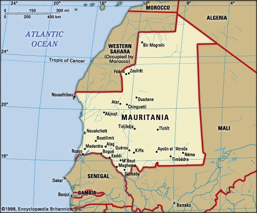
Mauritania, flag ofstate in northwestern Africa. It has the shape of an indented rectangle measuring about 930 miles (1,500 kilometres) from north to south and about 680 miles from east to west. It is bordered to the northwest by the Western Sahara (formerly Spanish Sahara), to the northeast by Algeria, to the east and southeast by Mali, and to the southwest by Senegal. Its Atlantic Ocean coastline, to the west, extends for 435 miles from the delta of the Sénégal River northward to the Cap Blanc Peninsula. The capital is Nouakchott.
Mauritania forms a geographic link between the North African Maghrib (a region that also includes Morocco, Algeria, and Tunisia) and the Senegal region of western Africa. Culturally it forms a transitional zone between the Arab-Berber region of North Africa and the region to the south of the tropic of Cancer known as the Sudan (a name derived from the Arabic bilād as-sūdān, “land of the blacks”). Much of Mauritania forms part of the western Sahara, and a large proportion of the population is nomadic. The country's mineral wealth includes large reserves of iron ore, copper, and gypsum, which are now all being exploited.
Mauritania, formerly French administered, became independent on Nov. 28, 1960. By the terms of the constitution, Islām is the official state religion, but the republic guarantees freedom of conscience and religious liberty to all. Arabic (Arabic language) is the national language, and the official languages are Arabic and French.
The land
Relief, drainage, and soils
Both land relief and drainage are influenced by the aridity that characterizes the greater part of the country. The impression of immensity given by the landscape is reinforced by its flatness; the coastal plains are lower than 150 feet (45 metres), while the higher plains of the interior vary from 600 to 750 feet. The interior plains form a plateau of which the culminating heights, occurring at different levels, form many tablelands joined to one another by very long, gentle slopes of about 2°. The topography is relieved by vestiges of cliffs (generally cuestas); by sloping plains that terminate at one end of the slope with a steep cliff or faulted scarp, which may reach heights of 900 feet; or by inselbergs (steep-sided residual hills), of which the highest is Mount Ijill at 3,002 feet (915 metres), an enormous block of hematite.
Structurally, Mauritania may be divided into three principal zones. The first of these, located in the north and northwest, consists of underlying Precambrian rock (about 2.7 billion years old), which emerges to form not only the backbone of northern Mauritania's Rigaibāt ridge region but also the Akjoujt rock series that forms a vast peneplain (a land surface worn down by erosion to a nearly flat plain) studded with inselbergs. The second zone is located partly in the extreme north but mostly in the centre and east. In the north it consists of primary sandstone, which covers the Tindouf Syncline (a fold in the rocks in which the strata dip inward from both sides toward the axis); in the centre is the vast synclinal basin of Taoudeni, bounded by the Adrar, Tagant, and ʾAçâba plateaus. The basin is scarcely indented to the south by the Hodh Depression, with the Affollé Anticline (a fold in which the rock strata incline downward on both sides from a central axis) lying in its centre. The third zone is formed by the Senegalese-Mauritanian sedimentary basin, which includes coastal Mauritania and the lower Sénégal River valley of the southwest.
The Mauritanian landscape in general, as a result of the arid phases it underwent during the Quaternary period (i.e., within the past 1.6 million years), presents three different aspects; these are represented by skeletal soils, regs (desert surfaces consisting of small, rounded, tightly packed pebbles), and dunes.
Skeletal soils are formed where outcrops of the underlying rock have been slightly weathered or where they have been covered with a patina or chalky crust. To these may be added the saline soils of the salt flats, formed from the caking of gypsum or of salt derived from the evaporation of former lakes. The regs form plains often of great extent, carpeted with pebbles and boulders. The dunes cover about 50 percent of the total area of the country. They are stretched out, often for several dozen miles, in long ridges known as ʾalâb, which are sometimes 300 feet high; they frequently overlap with one another, forming a network of domes and basins.
It is only to the south of the 10-inch isohyet (an imaginary line connecting points with equal rainfall) that the sands bear a brown type of soil. This soil is characteristic of the steppe (treeless plains) and contains 2 percent humus. It is also only in the extreme southern part of the country that the iron-bearing lateritic soils of the Sudanic zone begin; in the lowest places occur patches of hydromorphic soils—that is to say, soils that have been altered by waterborne materials.
The drainage system is characterized by a lack of pattern. Normal drainage is limited to inland southwestern Mauritania, where tributaries of the Sénégal River, which forms the frontier between Mauritania and Senegal, flow southward and are subject to ephemeral flooding in summer. In the greater part of the country, however, the plateaus are cut into by wadis (dry riverbeds), where the rare floods that occur dissipate their waters into a few permanent drainage basins called guelt (singular guelta). In the wastes of the north and the east, rainfall is so rare and slight that there is practically no runoff.
Climate
The climate owes its aridity to the northeastern trade winds (trade wind), which blow constantly in the north and throughout most of the year in the rest of the country; the drying effect produced by these winds is increased by the harmattan, or east wind. With the exception of the few winter rains that occur as a result of climatic disturbances originating in the mid-latitude regions, precipitation essentially results from the rain-bearing southwesterly winds, which progressively extend throughout the southern half of the country at the height of the summer. The duration of the rainy season, as well as the total annual amount of rainfall, diminishes progressively from south to north. Thus, Sélibaby in the extreme south receives about 25 inches (635 millimetres) between June and October; Kiffa, farther north, receives 14 inches between mid-June and mid-October; Tidjikdja receives seven inches between July and September; Atar receives seven inches between mid-July and September; and Nouadhibou receives between one and two inches, usually between September and November. Because of opposition between the wet southwesterlies and the harmattan, rains often take the form of stormy showers or squalls.
The strength of the sun and the lack of haze in these latitudes result in high temperatures. In the summer months afternoon temperatures exceed 100° F (38° C) at most stations, and daily highs of 115° F (46° C) are not uncommon in the interior. The average temperature in the coldest month at most stations is in the region of 68° F (20° C), while the average temperature during the hottest month rises to about 75° F (24° C) at Nouakchott in September, to about 79° F (26° C) at Kiffa in May, to 81° F (27° C) at Atar in July, and to 84° F (29° C) at Néma in May.
Plant and animal life
Vegetation zones depend upon the degree of aridity, which increases from south to north. The Sudanic (Sudan) savanna, studded with baobab trees and palmyra palm trees, gradually gives way in the extreme south to a discontinuous belt of vegetation known as the Sahel (an Arabic word meaning riverbank, or shore, which is also used to designate the southern Sahara borderlands). In the Sahel, trees are rare and the vegetation consists principally of acacias, euphorbia bushes (plants of the spurge family that have a milky juice and flowers with no petals or sepals), big tufts of morkba (Panicum turgidum, a type of millet), or fields of cram-cram, or Indian sandbur (Cenchrus biflorus, a prickly grass). Between the six-inch and four-inch isohyets the steppe rapidly disappears, giving way to desert. Vegetation is restricted to such places as the dry beds of wadis, beneath which water continues to flow, or to oases.
In the savanna, big antelope are hunted by lions, and, in the hilly Afollé region of southern Mauritania, herds of elephants are found. The steppe is frequented by gazelles, ostriches, warthogs, panthers, hyenas, and lynx; crocodiles are found in the guelt. Only addax antelope venture out into the waterless desert. Animal populations have been much reduced by hunting, obliging the authorities to introduce measures for conservation.
Settlement patterns
The Sahara region to the north, where habitation is generally limited to oases, stands in contrast to the Sahelian steppelands to the south, where regular rainfall permits extensive stock raising and some agriculture. While transition occurs between one zone and another, a convenient line of demarcation is represented by the four-inch isohyet.
The heartland of Mauritania consists of the vast Adrar and Tagant plateaus, known as the Trab el-Hajra (Arabic: “Country of Stone”). There, at the foot of cliffs, are found several oases, among which some—such as Chinguetti, Ouadane, Tîchît, Tidjikdja, and Atar—were the sites of well-known cities in the Middle Ages. To the north and the west extend the vast desert peneplains. The exploitation of the Zouîrât mines and the development of Nouadhibou have transformed this once-abandoned region into the focus of Mauritania's economic life.
Coastal southwestern Mauritania (under colonial rule, the Trarza cercle) is covered with regularly aligned dunes and is important for stock raising; Arab-Berber (Moorish) culture is represented by important marabout families.
Inland, southwestern Mauritania is inhabited by Moors and Fulani (Peul), who engage in both livestock raising and agriculture. In the extreme south, large villages are surrounded by fields of millet, constituting the first sign of the Sudanese landscape.
In the southeast the vast Hodh Basin, with its dunes, sandstone plateaus, and immense regs, is a major livestock-raising region, the economy of which has many links with neighbouring Mali.
Mauritania is a country suited for nomadic life. Livestock supplies the nomads with milk and meat, while transport is provided by riding camels and pack camels and, in the south, by pack oxen and donkeys as well. The women dye sheep's wool, with which they then braid long brown bands that are sewn together to make tents; they also tan goats' skins to make guerbas (waterskins). Movement is governed by the search for water and pasturage. In the Sahara nomadic movements are irregular because of the extreme variability of rains; in the Sahel, however, regular seasonal movement occurs—to the south in the dry season and back to the north in the wet season. Sizes of nomadic encampments also vary from south to north. In the coastal southwest, agglomerations of up to 300 tents may be found, whereas in northern Mauritania only groups of a few tents are to be seen.
For a variety of reasons—including changes in agricultural patterns as well as in political and commercial relations—the traditional nomadic way of life has been declining. Dams to conserve floodwaters have been built in the wadis, and palm tree culture has been considerably extended. The cumulative result of these developments has been that the nomads now tend to remain longer in the south near their millet fields and palm groves—becoming, in effect, seminomads.
Since the 1960s a movement toward settlement has been evident, largely because of growing dissatisfaction with the harsh conditions of nomadic life; this movement, however, has been restricted by the constant lack of water. Only in the extreme south—on the banks of the Sénégal River (in Mauritania the region called the Chemama)—is a normal, settled agricultural life possible. A series of droughts halted cultivation in the Sahel in the 1970s, and livestock raising was seriously constrained, affecting the livelihood of nomads and sedentary peoples alike.
The exploitation of the iron ore reserves of Mount Ijill, as well as the achievement of independence, have transformed the urban geography of Mauritania. The ancient cities that lived by caravan traffic—e.g., Tîchît, Chinguetti, Ouadane, and Oualâta—and traded with Casablanca and, above all, with Dakar have grown idle beneath their palm trees. Only Tidjikdja and Atar have maintained a certain activity. Kaédi, on the Sénégal River, has expanded and is still growing. Three new towns have been built: Nouakchott, the capital; Fdérik (formerly Fort-Gouraud); and Nouadhibou (formerly Port-Étienne).
Nouakchott was founded in 1958. Formerly, Mauritania shared a capital, Saint-Louis, in Senegal, with the other members of the French West African Federation. Nouakchott is located near the sea and provides access to the Sahara and Sahel regions alike. In addition to being the seat of government and administration, Nouakchott is a growing commercial centre and has a printing works, a hospital, and numerous schools. Its water supply is provided by a plant that desalinizes seawater.
Fdérik is an administrative centre situated about 15 miles from the mining town of Zouîrât. The port of Nouadhibou, which was long stagnant, owes its more recent expansion both to expanding iron ore exports and to the establishment of a fishing complex there. A few miles to the south lies Cansado, a residential suburb.
The people (Mauritania)
Ethnic and linguistic groups
The Moors (Moor) constitute more than two-thirds of the population; about half of them are white, or bīdān, Moors of Arab and Berber descent, and about half are black Moors, of Sudanic origin. Moorish society historically was divided into a hierarchy of castes. At the head of the socioeconomic structure were the noble castes, composed of ʿarabs, or warriors, and Murābit (marabouts), or priests and scholars of the Qurʾān. The warriors were usually Arab, and the marabouts were usually Berber. The mass of the bīdān population were vassals who received protection from the warriors or marabouts in return for tribute. There were two artisan classes—the blacksmiths and the griots (who were at once musicians and genealogists). Servant classes were formed of black Moors and were subdivided into ʿabid, or slaves, and hartani, or freedmen. Among the ethnic and racial groups, blacks became the better educated and held most technical, professional, and diplomatic posts at the time of independence. Members of this “servant” caste, which developed as the bureaucratic class, became increasingly aware of their rights as citizens. slavery was abolished by the French before independence and was officially abolished again on July 5, 1980, but subsequent reports claimed that the practice had continued. In 2007 the country's legislature passed a bill that made slavery a criminal offense.
The Moors speak Ḥassānīyah, a dialect that draws most of its grammar from Arabic and uses a vocabulary of both Arabic and Berber words. Most of the members of the aristocratic castes also know literary Arabic.
The remaining population, generally referred to as kewrin, consists of Tukulor (Toucouleur), who live in the Sénégal River valley; Fulani, who are dispersed throughout the south; Soninke (Sarakole), who inhabit the extreme south; and Wolof (Oulof), who live in the vicinity of Rosso in coastal southwestern Mauritania. The Tukulor and the Fulani speak Fula, and the other ethnic groups have retained their respective languages.
Of Mauritania's total population an estimated one-fourth are nomads, and about one-third live in and around urban centres. Because of the country's large desert area, the average density is the lowest in western Africa. Three-fourths of Mauritanians live in the Sénégal River valley. Life expectancies stand at 44 and 47 years respectively for men and women.
Most of the non-Africans in Mauritania are French nationals engaged in technical assistance, commerce, and mining; Spaniards represent the second largest foreign community.
Religious groups
About 99 percent of all Mauritanians are Muslim. Most Moors belong to the Qādirīyah order. The Tukulor and some of the Tagant tribes belong to the Tijānīyah order. Many tariqas (mystical sects) flow from these orders.
The economy
In the Sahel region of Mauritania a traditional subsistence economy is maintained, composed of livestock raising, agriculture, crafts, and petty trading. In the Sahara region, however, a modern economy is developing, based on the exploitation of iron-ore and copper resources and of the ichthyologically-rich continental shelf; the modern economy receives much needed capital investment and technical assistance from abroad. More than three-quarters of the Mauritanian population still lives by traditional activities, among which livestock raising is the most important. In numbers, goats and sheep are the most important livestock, followed by cattle, camels, donkeys, and horses. Cattle are raised primarily in the southern region, whereas goats and sheep are dispersed as far north as the limits of the Sahara. Camels are raised mostly in the north and the centre, especially in the Adrar region. The growth of the Mauritanian economy slowed in the 1980s after a lengthy period of rapid expansion in the 1960s and '70s. Agriculture and fishing account for almost one-third of the gross national product, with the industrial sector, including mining, contributing about one-quarter, public administration about 15 percent, and the remaining sectors about 30 percent.
The state imposes indirect taxes on imports, a turnover tax on exports and mining, a service tax, and taxes on cattle, vehicles, wages and salaries, and profits from industrial and commercial concerns.
Mauritania's budget, usually in deficit, was nominally balanced in the late 1980s. In the mid-1980s, principal and interest on a relatively large foreign indebtedness was rescheduled, but indebtedness remains a significant problem. Foreign aid, both bilateral (from France, Japan, China, the United States, and the Arab states) and by multilateral agencies (such as the African Development Bank, International Monetary Fund, International Bank for Reconstruction and Development, and the European Economic Community), is primarily targeted to assist in project development but is also used for budgetary and food support.
Agriculture and fishing
Agriculture is necessarily dependent upon rainfall. Where the rainfall exceeds 17 inches a year, millet (fonio) and dates are the principal crops, supplemented by sorghum, beans, yams, corn (maize), and cotton. Seasonal agriculture is practiced on the easily flooded riverbanks and in the wadis of the Sahelian zone, upstream from the dams. There, too, millet, sorghum, beans, rice, and watermelons are grown. Irrigated agriculture is practiced in areas supplied by water-control projects and at oases, where well water is available; corn, barley, and some millet and vegetables are grown. The output of gum arabic is less than it was in former years. Agricultural production in Mauritania has continued to decline because of drought. Crop production fell by approximately two-thirds in the period from 1970 to 1980. From the late 1970s Mauritania was unable to produce more than half of its total food requirements.
In agriculture the aim of successive Mauritanian governments has been to increase the amount of irrigated land in the Sénégal River valley and, above all, to increase the production of rice, of which Mauritania is still obliged to import large quantities, to plant fresh palm trees to replace those destroyed by the cochineal insect, to drill fresh wells, to improve the quality of dates, and to encourage the cultivation of vegetables.
Rich fishing grounds lie off Mauritania's Lévrier Bay. Mauritania stopped issuing fishing licenses in 1979, however, and in 1980 formed joint companies with Portugal, Iraq, South Korea, Romania, and the Soviet Union. In 1987, fisheries agreements were signed with the European Communities. At Nouadhibou fish are canned, frozen, or processed as fish flour. Several tons each year are dried and exported to other African countries.
Mining
A rail link connects the mining town of Zouîrât with the port of Nouadhibou (Nouâdhibou), the only deepwater roadstead on the Saharan coastline, accommodating ships of up to 150,000 tons. Iron exploitation was organized and begun in 1963 by Miferma (of which 56 percent of the financing was by French groups and the remainder by British, West German, and Italian groups and by the Mauritanian government). The company was nationalized in 1974 and was renamed Cominor (Complexe Minier du Nord). The iron ore deposits of Mount Ijill have nearly been exhausted, and exploitation of reserves at Guelbs began in 1984. Iron exports fell from a peak of 12 million tons in 1974 to an annual average of nine million tons in the 1980s.
The copper deposits of Akjoujt are extensive, with a copper content of more than 2 percent. Exploitation was begun in 1969 by Somima (Société Minière de Mauritanie), of which 54 percent of the shares were held by British and U.S. interests, 25 percent by the Mauritanian government, and the remainder by French interests. Somima was nationalized in 1975, but operations were suspended in 1978. Reactivation of the mine remains a constant preoccupation, as does the extraction of gold from the copper ore. Processed copper had been exported along a highway to the wharf at Nouakchott. There are substantial gypsum deposits near Nouakchott; most of the annual production is exported to Senegal. Other mineral resources are minor, and salt output has declined. Reserves of ilmenite (the principal ore of titanium) have been located, and phosphate deposits have been identified near Bofal in the south. Oil prospecting has so far yielded no results.
Finance and trade
The national Banque Centrale de Mauritanie was established in 1973. In addition there are five commercial banks. There are no securities exchanges in Mauritania, and the government controls all insurance business.
Foreign trade is difficult to estimate because, while imports and exports of the modern sector are well known, there are no statistics for the traditional sector. Mauritania is nevertheless known to import from or by way of Senegal quantities of millet, tea, rice, sugar, cotton goods, and hardware, while it exports to Mali and to Senegal cattle, sheep, and goats. Iron ore together with fish and fish products constitute the major exports.
Transportation
Transport by pack animals—camels in the north, oxen and donkeys in the south—has retained considerable importance in a society in which a subsistence and barter economy prevails, although transport between cities and regions is increasingly by truck. Considerable hazards, however, confront road builders; among these are moving sand dunes, flash floods in the south, and steep cliffs. Only the main road running from Rosso via Nouakchott, Akjoujt, Atar, Fdérik, and Bir Mogreïn to Tindouf, Algeria, is passable throughout the year. The road between Rosso and Nouakchott is surfaced, as is the section between Nouakchott and Akjoujt. The Trans-Mauritania highway, linking Nouakchott, Kaédi, Kiffa, ʿAyoûn el-ʾAtroûs, and Néma, was completed in 1982. The railroad from Zouîrât to Nouadhibou is used only for transporting iron ore. There are international airports at Nouakchott and Nouadhibou, and other cities are linked by regular air services.
The irregularity of the flow of the Sénégal River limits its use as a waterway; Kaédi can be reached only by ships drawing about seven feet at the high-water season, normally from August to October. The port facilities at Nouakchott can accommodate 320,000 tons of shipping a year. Nouadhibou, in addition to being an iron ore and fishing port, is also a commercial port.
Administration and social conditions
Government
The Mauritanian state had a presidential regime from 1960 until 1978, when a coup d'état installed a military government. A civilian government established in December 1980 was replaced the following April by a largely military administration. A new constitution in 1991 established a multiparty system and a new bicameral legislative structure.
The primary task of Mauritania's successive governments has been to transform a community of diverse tribes, hierarchical in social structure and very strongly differentiated, into a nation. Many of the local barriers to cooperation have been overcome, and traditional regional boundaries have been redrawn. There are 12 administrative regions, each directed by a governor, with the capital forming a separate district.
Islāmic law and jurisprudence have been in force since February 1980. Qāḍīs (judges of the Sharīʿah, or Islāmic law) in rural and town communities hear cases relating to marriage, divorce, and other personal status issues. Nouakchott is divided into six regional sections where magistrates and judges hear cases in lower courts; there are also labour and military courts, the Court of State Security, and a Supreme Court, which deals with administrative as well as judicial matters.
Education
Less than two-fifths of Mauritania's adult population is literate. Schooling is compulsory to age 14, but, in fact, only a small minority of children benefit from it. In addition to primary schools in the urban centres, there are secondary schools, a university with faculties of letters and human sciences and of law and economics, and a research institute for mining and industry in Nouakchott. The capital is also the site of a national library. There are traditional local libraries in some urban centres.
Health and welfare
Modern health facilities are scarce in Mauritania, with only one major hospital in Nouakchott and 25 other regional health centres, of which 15 are maternity clinics. Free medical services are available to the poor. Traditional medicine flourishes. Among other health problems found in tropical areas, tuberculosis and intestinal and eye maladies are widespread. Disability payments for industrial accidents and occupational diseases, family allowances, and old-age pensions are administered by the National Social Insurance Fund.
Cultural life
Moorish society is proud of its Arab and Muslim heritage. Theology, poetry, and music flourish. Goldsmithing is a fine art. Kewri societies have a rich and varied folklore.
Mail, telephone, and telegraph services are combined in the main post offices. Fewer than 15,000 telephones are in use, and administrative contact is primarily through radiotelephone. International telephonic communications are run through Paris. The media are owned or controlled by the government. A national radio network broadcasts in the prevailing languages and in French. There are also two Earth satellite stations with telecasts in French and Arabic. A daily, Ach-chaab; a biweekly, Journal Officiel; and a bimonthly, Le Peuple, are published in the two official languages. Movie theatres are found in the main urban centres, and cercles (social, sporting clubs) provide recreational opportunities in Nouakchott, Nouadhibou, and Rosso.
History
Numerous Stone Age remains have been discovered in northern Mauritania, dating from the Lower Paleolithic (Acheulian) and Neolithic periods. In historical times Mauritania was settled by both sub-Saharan peoples and by the Sanhaja Imazighen (Berbers). The region was the cradle of the Amazigh (Berber) Almoravid (Almoravids) movement, which spread an austere form of Islam to all the neighbouring peoples in the 11th century AD. A caravan route linked Mauritania with Morocco at that time. Arab tribes following this route in the 15th century soon outnumbered the Imazighen, and a mixed Arab-Amazigh, or Moorish, culture was born. These nomadic tribes formed several powerful confederations: the Trarza and Brakna, which dominated the Sénégal River valley; the Kunta in the east; and the Rigaibāt (Regeibat) in the north.
European intervention
In 1442 Portuguese mariners rounded Cape Blanc, and in 1448 they founded the fort of Arguin, whence traders shipped gold, gum arabic, and slaves. Later French and English shipping frequented Portendick, and the French settled at Saint-Louis at the mouth of the Sénégal River. In 1858 Colonel Louis Faidherbe (Faidherbe, Louis) waged a military campaign that ended Moorish domination in lower Senegal. After 1898 an Orientalist, Xavier Coppolani, succeeded in rallying all the Moors of the south to French allegiance. His work was completed by Colonel Henri Gouraud, who occupied Tagant in 1907 and Adrar in 1909. The Rigaibāt were not finally subjugated until 1955.
Mauritania was constituted a territory of French West Africa in 1920 and later became a French colony; it was at first governed from Saint-Louis in Senegal. In 1946 Mauritania became a French overseas territory and in 1957, after repulsing an attack by Moroccan irregulars on the north, elected a government under Moktar Ould Daddah (Daddah, Moktar Ould), who established the new capital at Nouakchott. In 1958 Mauritania voted to become a member state of the French Community.
Independence
Mauritania's small political elite was divided over whether the country should be oriented more toward Senegal and French-speaking sub-Saharan Africa or toward Arab Muslim Morocco—whose leaders sought to absorb Mauritania. The winning faction, under Sidi el-Moktar N'Diaye and his political successor, Ould Daddah, chose independence—which the country declared on November 28, 1960—with close ties to France. The new state became a member of the United Nations in 1961. Mauritania opted for full participation in the Organization of African Unity and joined the Arab League in 1973.
As Mauritania's first postindependence president, Ould Daddah appeared securely established in spite of occasional strikes by miners and demonstrations by students, because his policies seemed attuned to a population that was largely tribal and engaged in agriculture or pastoralism. King Hassan II of Morocco had reversed his policy and recognized Mauritanian independence in 1969 as part of his plan to gain control of what was then Spanish Sahara (now Western Sahara), and Morocco and Mauritania divided that country in 1976. The difficulties of suppressing guerrillas of the Polisario (Polisario Front) Front in Mauritania's portion of Western Sahara contributed to Ould Daddah's downfall, and he was deposed and exiled in a military coup led by the chief of staff, Colonel Mustapha Ould Salek, in July 1978.
Ould Salek resigned his position in June 1979, and under his successor, Lieutenant Colonel Mohamed Mahmoud Ould Louly, Mauritania signed a treaty with the Polisario Front in August in an effort to disentangle itself from Western Sahara. This worsened relations with Morocco. Louly was in turn replaced in January 1980 by the prime minister, Lieutenant Colonel Mohamed Khouna Ould Haidalla. In December 1984 Colonel Maaouya Ould Sidi Ahmed Taya took over the presidency and the office of prime minister from Haidalla in a bloodless coup, and Mauritania renewed diplomatic ties with Morocco in 1985, seeking again to resolve the dispute in Western Sahara. Taya was victorious in the country's first multiparty presidential elections in 1992 and was reelected in 1997 and 2003. The elections, however, drew allegations of fraud.
In August 2005, while Taya was out of the country, army officers staged a successful coup. Colonel Ely Ould Mohamed Vall, a former close ally of Taya, emerged as the leader of the ruling Military Council for Justice and Democracy. He pledged that democracy would be restored, and in 2006 he presented a referendum on constitutional reforms. Voters overwhelmingly approved the changes, which included limiting presidents to two consecutive terms of five rather than six years. In March 2007 presidential elections were held, and Sidi Ould Cheikh Abdallahi became Mauritania's first democratically elected president.
Criticism against President Abdallahi simmered in the months following his election, and tensions escalated in May 2008 when Abdallahi appointed a number of ministers who had held important posts in Taya's government, some of whom had been accused of corruption. The parliament passed a vote of no confidence in July, which was followed by the departure of almost 50 ruling-party members of parliament in early August. On August 6, 2008, President Abdallahi dismissed a number of high-ranking army officials rumoured to have been involved in the parliamentary crisis; in response the military promptly staged a coup and removed him from power.
Ed.
Additional Reading
Introductions include Alfred G. Gerteiny, Mauritania (1967); Brian Dean Curran and Joann Schrock, Area Handbook for Mauritania (1972); Charles Toupet and Jean-Robert Pitte, La Mauritanie (1977); and Charles Toupet and Georges Laclavère, Atlas de la République Islamique de Mauritanie (1977). Charles Toupet, La Sédentarisation des nomades en Mauritanie centrale sahélienne (1977), studies geographic and social transformations. The economy is treated in Richard M. Westebbe, The Economy of Mauritania (1971); and Jérôme Pujos, Croissance économique et impulsion extérieure: étude sur l'économie mauritanienne (1964). Alfred G. Gerteiny, Historical Dictionary of Mauritania (1981), is a good reference. Specific periods are examined in C.C. Stewart and E.K. Stewart, Islam and Social Order in Mauritania: A Case Study from the Nineteenth Century (1973); Francis de Chassey, Mauritanie, 1900–1975 (1978, reissued 1984); and Geneviève M. Désiré-Vuillemin, Contribution à l'histoire de la Mauritanie de 1900 à 1934 (1962).
- Cape Coast
- Cape Cod
- Cape Cod Canal
- Cape Colony
- Cape Comorin
- Cape Coral
- Cape Corrientes
- Cape Dezhnyov
- Cape Diamond
- Cape emerald
- Cape Fear River
- Cape Flats
- Cape flora
- Cape Frio
- Cape Frontier Wars
- Cape Girardeau
- Cape Gracias a Dios
- Cape Hatteras
- Cape Hatteras National Seashore
- Cape Henry
- Cape Horn
- Cape Howe
- Cape, Jonathan
- Cape Krusenstern National Monument
- capelin