Pacific Ocean
Introduction
 body of salt water extending from the Antarctic region in the south to the Arctic in the north and lying between the continents of Asia and Australia on the west and North (North America) and South America on the east.
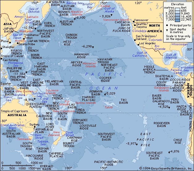
Of the three oceans that extend northward from the Antarctic (Antarctica) continent, the Pacific is by far the largest, occupying about a third of the surface of the globe. Its area, excluding adjacent seas, encompasses about 63.8 million square miles (165.25 million square km). It has double the area and more than double the water volume of the Atlantic Ocean—the next largest division of the hydrosphere—and its area more than exceeds that of the whole land surface of the globe. The Pacific Ocean stretches from the shores of Antarctica to the Bering Strait through 135° of latitude, some 9,600 miles (15,500 km). Its greatest longitudinal extent measures some 12,000 miles (19,300 km) along latitude 5° N, between the coasts of Colombia in South America and the Malay Peninsula in Asia. The mean depth of the Pacific (excluding adjacent seas) is 14,040 feet (4,280 metres), and its greatest known depth is 36,201 feet (11,034 metres)—in the Mariana Trench—also the greatest depth found in any ocean.
In the Northern Hemisphere the Pacific Ocean meets the Arctic Ocean in the Bering Sea. In the Southern Hemisphere the Pacific and Atlantic mix in the relatively narrow Drake Passage between Tierra del Fuego in South America and Graham Land in Antarctica. The separation between the Pacific and Indian (Indian Ocean) oceans is less distinct, but generally it is considered to lie along the line of islands extending eastward from Sumatra, through Java to Timor, thence across the Timor Sea to Cape Londonderry in Australia. To the south of Australia the boundary extends across the Bass Strait and thence from Tasmania to Antarctica. The portion of the Pacific near Antarctica sometimes is considered to be part of the Southern Ocean.
Because of the pattern of major mountain systems of the globe, a relatively small proportion (one-seventh) of the total continental drainage enters the Pacific—a total drainage area of less than about three times the total area of Australia. Of the rivers that drain into the Pacific, those of China and Southeast Asia are of the greatest importance; the basins of those rivers support more than one-fourth of the world's population.
The eastern boundary of the Pacific is associated with the American cordilleran system, which stretches from Alaska in the north to Tierra del Fuego in the south. Except for its extreme northern and southern sections, which are characterized by fjords (fjord) and their numerous off-lying islands, and except for the deeply indented Gulf of California (California, Gulf of), the coastal boundary is relatively regular and the continental shelf narrow. The western, or Asiatic, coastal boundary, in contrast, is irregular. Although the mountain systems there lie roughly parallel to the coast, as they do on the eastern Pacific coastlands, the western Pacific is noted for its many marginal seas. From north to south they include the Bering Sea, the Sea of Okhotsk (Okhotsk, Sea of), the Sea of Japan (Japan, Sea of) (East Sea), the Yellow Sea, the East China Sea, and the South China Sea. Their eastern boundaries are formed by southward-jutting peninsulas or island arcs (island arc) or both. It is of oceanographic significance that the great rivers of eastern Asia—including the Amur (Amur River), the Huang He (Yellow River), the Yangtze (Yangtze River), the Xi (Xi River system) and Pearl (Pearl River Delta) (Zhu), and the Mekong (Mekong River)—enter the Pacific indirectly by way of the marginal seas.
This article treats the physical and human geography of the Pacific Ocean. For discussion of the physical and chemical oceanography and marine geology of the Pacific, see ocean.
Physiography
Relief
The Pacific basin may conveniently be divided into three major physiographic regions: the eastern, western, and central Pacific regions.
Eastern region
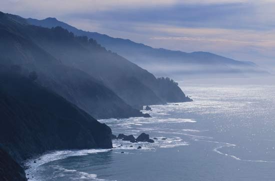 The eastern Pacific region, which extends southward from Alaska to Tierra del Fuego, is relatively narrow and is associated with the American cordilleran system of almost unbroken mountain chains, the coastal ranges of which rise steeply from the western shores of North and South America. The continental shelf, which runs parallel to it, is narrow, while the adjacent continental slope is very steep. Significant oceanic trenches (deep-sea trench) in this region are the Middle America Trench in the North Pacific and the Peru-Chile Trench in the South Pacific.
Western region
 The seaward boundary of the western Pacific region is marked by a broken line of oceanic trenches, extending from the Aleutian Trench in the north through the Kuril (Kuril Trench) and Japan (Japan Trench) trenches and southward to the Tonga (Tonga Trench) and Kermadec (Kermadec Trench) trenches, terminating close to the northeast of North Island, New Zealand. Its structure is more complex than that of the eastern region. Characteristically associated with the ocean trenches of the western region are festoons of either peninsulas or islands or both. The islands, which include those of Japan as well as numerous smaller islands, represent the upper parts of mountain systems that rise abruptly from the deep ocean floor. The island clusters of the western Pacific form the boundaries of the several wide and deep continental seas of the region.
Central region
The central Pacific region lies between the boundaries of the eastern and western regions. The largest and the most geologically stable of the structural provinces of the Earth's crust, it is characterized by expansive areas of low relief, lying at a general depth of about 15,000 feet (4,600 metres) below the surface.
Principal ridges (oceanic ridge) and basins
 To the east of longitude 150° W, the relief of the ocean floor is considerably less pronounced than it is to the west. In the eastern Pacific the Cocos Ridge extends southwestward from the Central American isthmus to the Galapagos Islands. To the south of the Galapagos lies the Peru Basin, which is separated by the extensive Sala y Gómez Ridge from the Southeast Pacific Basin, which in turn is separated from the Southwest Pacific Basin by the East Pacific Rise and indeterminate Pacific-Antarctic Ridge, which runs from the Sala y Gómez Ridge to Antarctica in the vicinity of 150° W.
Extending southward from the Tasman Basin (between New Zealand and eastern Australia) is the Macquarie Ridge, which forms a major boundary between the deep waters of the Pacific and Indian oceans. The Hawaiian Ridge extends westward from Hawaii to the 180° meridian.
The submerged parts of the series of ridges that are capped by the island archipelagoes of the western Pacific are continuous and are to be found at depths of less than about 2,000 feet (610 metres). These ridges include the Aleutian Ridge in the northwestern Pacific; the series of ridges extending southward through the Kuril (Kuril Islands), Bonin (Bonin Islands), and Mariana (Mariana Islands) island groups, and the archipelagoes of Yap (Yap Islands) and Palau; those extending eastward from New Guinea, including the Bismarck Archipelago and the Solomon (Solomon Islands) and Santa Cruz (Santa Cruz Islands) island chains; and, finally, the ridges extending southward, from which rise the Samoa, Tonga, Kermadec (Kermadec Islands), and Chatham (Chatham Islands) island groups, as well as Macquarie Island.
Bottom deposits
 Apart from the narrow coastal zone of the eastern region and the broad continental seas of the western region, the Pacific is floored with pelagic (oceanic) material derived from the remains of marine plants and animals that once inhabited the waters lying above. Red or brown radiolarian ooze is found along the zone of the Pacific North equatorial current, east of longitude 170° W, and on the floors of some deep Indonesian basins. A belt of diatom ooze occurs between latitudes 45° and 60° S and across the North Pacific, between Japan and Alaska. Calcareous globigerina ooze occurs in the shallower parts of the South Pacific, the dissolving power of the seawater at great depths being sufficient to dissolve calcareous material to such an extent that these oozes are not generally found at depths in excess of about 15,000 feet (4,600 metres). Silica-containing material, such as radiolarian and diatom ooze, is found at greater depths, but even these siliceous remains are dissolved at very great depths, where the characteristic deposit is red clay. Red clay, which covers no less than half of the Pacific floor, is believed to be formed of colloidal (extremely finely divided) clays derived essentially from the land.
On the abyssal plains (abyssal plain), where sediments accumulate slowly, chemical and biological processes lead to the formation of metal-bearing coatings around objects such as the ear bones of fishes. The nodules (nodule) so formed contain manganese, iron, nickel, copper, cobalt, and traces of other metals such as platinum. They cover large areas of the ocean floor in the Pacific. Similar processes form coatings, called manganese crusts, on the rock surfaces of seamounts (seamount).
Among the many different forms of land-derived muds (formed by the erosive action of rivers, tides, and currents) that floor the continental shelves and slopes of the Pacific, the yellow mud of the Yellow Sea is of particular interest. The mud is conveyed to the seabed by the Huang He, which drains a vast area of northern China blanketed with loess, a fine-grained soil.
Islands (Pacific Islands)
 The islands of the western region—including the Aleutians (Aleutian Islands), the Kurils, the Ryukyus (Ryukyu Islands), Taiwan, the Malay Archipelago (including New Guinea), and New Zealand—are continental in character. Geologically, they consist partly of sedimentary rocks (sedimentary rock), and their structures are similar to those of the coastal mountain ranges of the adjacent continent.
A geologically important boundary between the continental, or “high,” islands and the numerous truly oceanic, or “low,” islands of the Pacific is the Andesite Line, a region of intense volcanic and seismic activity. In the northern and western Pacific the Andesite Line follows close to seaward the trend of the island arcs from the Aleutians southward to the Yap and Palau arcs, thence eastward through the Bismarck, Solomon, and Santa Cruz archipelagoes, and thence southward through the Samoa, Tonga, and Chatham groups and Macquarie Island to Antarctica. Islands to the west of the line are rich in andesite, a type of intrusive igneous rock; islands to the east (oceanic side) of it are essentially of basalt, an extrusive igneous rock.
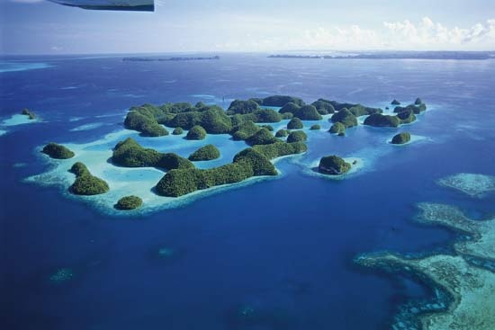
The numerous oceanic islands of the Pacific are unevenly distributed. They lie, in the main, between the Tropics of Cancer and Capricorn and occur in great numbers in the western Pacific. The northernmost chain of oceanic islands is associated with the Hawaiian (Hawaii) Ridge. The Hawaiian archipelago consists of about 2,000 islands, although the term Hawaiian Islands is usually applied to the small group that lies at the eastern end of the archipelago.
 The numerous small islands of Micronesia (Micronesian culture) lie mainly north of the Equator and to the west of the 180° meridian. Nearly all are coralline; the principal groups are the Marianas, the Marshalls (Marshall Islands), the Carolines (Caroline Islands), Kiribati (Gilbert Islands), and Tuvalu (Ellice Islands).
To the south of Micronesia lies Melanesia (Melanesian culture), which consists mostly of small coral islands. The region's physiography is dominated by a group of large continental islands, however, including New Guinea. The principal Melanesian island groups are the Bismarck Archipelago, the Solomons, Vanuatu (New Hebrides), New Caledonia, and Fiji.
The immense area of Polynesia (Polynesian culture) includes the Hawaiian Islands, the Phoenix Islands, Samoa, Tonga, the Cook Islands, the Society Islands, Tuamotu (Tuamotu Archipelago), and the Marquesas (Marquesas Islands).
Geology
 Evidence drawn from various geophysical fields— seismology, volcanology, gravimetry, and paleomagnetism ( remanent magnetism)—points to the general validity of the theory of plate tectonics. All the major physical features in the Pacific are understood to originate in plate tectonics. The western Pacific arcs of volcanic islands and deep trenches are convergent zones where two plates are colliding, one being subducted (forced under the other). The East Pacific Rise is an active spreading centre where new crust is being created. The northeastern Pacific margin is the strike-slip zone where the American Plate and the Pacific Plate are gliding laterally past each other via the major San Andreas Fault system. In the southeastern Pacific, however, the Nazca Plate and the South American Plate are colliding to form the Andes Mountains along western South America and, a short distance offshore, the Peru-Chile Trench. The floor of the northeastern Pacific is remarkable for its several major fracture zones (submarine fracture zone), which extend east and west and which, in some instances, are identifiable over distances of thousands of miles.
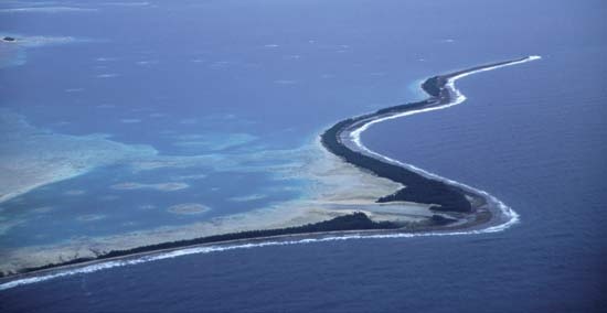
Of great geologic interest are the seamounts (seamount) (submerged volcanoes), guyots (guyot) (flat-topped seamounts), and oceanic islands of the Pacific. The numerous tropical islands of the Pacific are mainly coralline. The principal types of coral reefs (coral reef)—fringing (fringing reef), barrier (barrier reef), and atoll—as well as the guyots, which rise within the Pacific from the ocean floor in latitudes north and south of the tropics, are explained partially by the slow subsidence theory advanced by the English naturalist Charles Darwin (Darwin, Charles) during the 19th century and partially by the theory of plate tectonics.
Climate
The wind and pressure systems of the Pacific conform closely to the planetary system—the patterns of air pressure and the consequent wind patterns that develop in the atmosphere of the Earth as a result of its rotation ( Coriolis force) and the inclination of its axis ( ecliptic) toward the Sun. They are, in essence, a three-celled latitudinal arrangement of the atmospheric circulation, with the systems in the Northern and Southern hemispheres mirroring each other on opposite sides of the Equator. The vast extent of open water in the Pacific influences wind and pressure patterns over it, and climatic conditions in the southern and eastern Pacific—where the steadiness of the trade winds (trade wind) and the westerlies is remarkable—are the most uniform on the globe. In the North Pacific, however, conditions are not so uniform, particularly the considerable climatic differences between the eastern and western regions in the same latitude. The rigour of the winters off the east coast of Russia, for instance, contrasts sharply with the relative mildness of winters in the region of British Columbia.
The trade winds (trade wind)
 The trade winds of the Pacific represent the eastern and equatorial parts of the air circulation system; they originate in the subtropical high-pressure zones (subtropical high) that are most pronounced over the northeast and southeast Pacific between latitudes 30° and 40° N and S, respectively. The obliquity of the ecliptic (an angle of approximately 23 1/2° that is the difference between the planes of the Earth's rotation on its axis and its revolution around the Sun) limits the seasonal shifting of the Pacific trade-wind belts to about 5° of latitude. The easterly winds between the two subtropical zones form the intertropical airflow and tend to be strongest in the eastern Pacific. The equatorial region, where the trade winds of the Northern and Southern hemispheres converge, is an area of calms or light variable breezes and is known as the doldrums.
The trade winds, especially in the eastern Pacific, convey relatively cool air toward the Equator; in moving, the air comes in contact with the sea and thus becomes increasingly humid and warm, and high lapse rates (lapse rate) (the term used to denote the rate of change of air temperature with increasing height above sea or land surface) result. The average wind speed of the Pacific trade winds is about 15 miles (24 km) per hour. The weather in the trade-wind belts is normally fine, with relatively little cloud cover; such clouds as there are characteristically take the form of broken cumulus (small piles of clouds with flat bases) at about 2,000 feet (600 metres) above sea level. Precipitation, usually in the form of light showers, is slight.
Off the west coasts of the American continents in the trade-wind belts, upwelling of cold subsurface water causes the overlying air to be cooled below its dew point (the air temperature below which water vapour condenses as dew), with the consequent widespread formation of low, thick clouds. fog in those regions is not uncommon.
Tropical storms
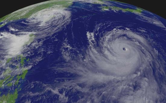 Although in general the climatic conditions of the trade-wind belts are characteristically regular and uniform, storms of great violence do originate there. In such storms, winds of exceptionally strong force spiral inward toward a centre of exceedingly low atmospheric pressure. These storms, generically called tropical cyclones (tropical cyclone), are known in the western Pacific as typhoons (typhoon); Australians use the term cyclones for those that occur several times a year off that continent's northeast coast and batter the Great Barrier Reef. While the mechanism that triggers typhoons and other tropical storms is not completely understood, ideal conditions for their development occur in the western Pacific between latitudes 5° and 25° N during late summer and early autumn, when the temperature of surface waters is at least 81 °F (27 °C). The regions to the east of the Philippines and in the South and East China seas are notorious for these storms, which imperil shipping and often cause severe coastal flooding accompanied by loss of life and property.
The westerlies
Within the belts of the westerly winds, cold easterly winds from polar regions meet the warm westerly winds of the middle latitudes, causing the formation of the traveling depressions characteristic of middle latitudes. The zone of convergence, or polar front, is most strongly developed in winter, when the contrast in temperature and humidity of the air between the converging flows is greatest.
The westerlies in the Southern Hemisphere are steady and strong, and their popular name, “brave west winds,” is apt. The gales that accompany the depressions have given rise to the term “roaring forties,” (roaring forties) named for the latitudinal zone in which the storm winds are of greatest frequency.
The monsoon regime
The western Pacific is subject to a seasonal climatic regime that replaces the planetary system. This is the regime of the monsoon (rain-bearing winds), which is associated with the heating of the Asian landmass in summer and its intense cooling in winter. The heating of air masses over tropical Asia in summer initiates a low-pressure system, which becomes the focal point of the trade winds of both hemispheres. The doldrums, therefore, do not exist in the western Pacific during northern summer because of the immense flow of maritime air into the Asian low-pressure zone. The cooling of the continent in winter results in the development of the Asian high-pressure system, which leads to a strengthening of the trade winds of the Northern Hemisphere.
As a result of seasonal changes in pressure and wind circulation, marked seasonal contrast between continental and maritime influences—the first associated with drought and cold and the second with moisture and heat—is to be found in the whole of the western Pacific from the Sea of Japan southward.
temperature and salinity
Temperature
The oceans tend to be stratified, the principal factor being temperature; the bottom waters (bottom water) of the deep parts are intensely cold, with temperatures only slightly above freezing.
The surface zone, where temperature variations are perceptible, is between 330 and 1,000 feet (100 and 300 metres) thick. It is more compressed in the temperate eastern Pacific, along the coasts of North and Central America, where cold water appears at a shallower depth compared with the central and western Pacific.
Ocean temperatures in the North Pacific tend to be higher than those in the South Pacific because the ratio of land to sea areas is larger in the Northern Hemisphere and because Antarctica also influences water temperature.
The mean position of the thermal equator (the line on the Earth on which the highest average air temperatures are found; the line migrates latitudinally with the changing angular distance from the Equator of the Sun) in the Pacific, although it lies in the Northern Hemisphere, is nearer to the geographic equator than in the Atlantic and Indian oceans.
There is a pronounced difference in temperature and salinity between the surface and deep zones of the Pacific. The deep zone, which contains about 80 percent of the ocean's volume, has relatively stable temperature and salinity patterns; its average temperature is 38.3 °F (3.5 °C).
Salinity
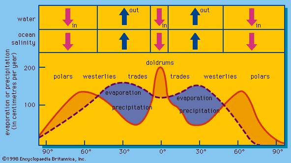 The salinity patterns of the surface waters of the Pacific are influenced largely by wind and by precipitation and evaporation patterns. The waters within the belt of calm and variable winds near the Equator have lower salinities than those in the trade-wind belts. In the equatorial belt, relatively large amounts of rain fall and little evaporation occurs, both because of low wind speeds and because of the generally cloudy skies; salinity in the equatorial belt runs as low as 34 parts per thousand.
The highest surface salinities in the open Pacific occur in the southeastern area, where they reach 37 parts per thousand; in the corresponding trade-wind belt in the North Pacific, the maximum salinity seldom reaches 36 parts per thousand. Pacific waters near Antarctica have salinities of less than about 34 parts; the lowest salinities—less than about 32 parts—occur in the extreme northern zone of the Pacific.
The heavy rainfall of the western Pacific, associated with the monsoons of the region, gives rise to relatively low salinities. Seasonal variations are significant in the western Pacific as well as in the eastern Pacific, caused by seasonal changes in surface currents.
Hydrology
Surface currents
Pacific trade winds drive surface waters toward the west to form the North and South Equatorial currents, the axes of which coincide with latitude 15° N and the Equator, respectively. Squeezed between the equatorial currents is a well-defined countercurrent (equatorial countercurrent), the axis of which is always north of the Equator and which extends from the Philippines to the shores of Ecuador.
The major part of the North Equatorial Current swings northward in the vicinity of the Philippines to form the warm Kuroshio (also called the Japan Current). To the east of Japan the Kuroshio swings eastward to form the Kuroshio Extension. The branching of this current in the region of 160° E results in the movement known as the North Pacific Current. The surface waters of the Bering Sea circulate in a counterclockwise direction. The southward extension of the Kamchatka Current forms the cold Oya Current, which flows to the east of the Japanese island of Honshu to meet the warm Kuroshio (Tsushima Current) waters in the vicinity of 36° N. The cold, southeast-flowing California Current forms the eastern segment of the returning branch of the North Equatorial Current system.
The main part of the South Equatorial Current divides into three large branches as it flows westward. The two westernmost branches, on reaching the east coast of Australia, swing south to form the East Australian Current, which, becoming the Tasman Current, turns back to the northeast and dissipates west of New Zealand. The easternmost branch flows first to the south, roughly along the 180° meridian, before turning back to the east in the vicinity of 50° S as the warm South Pacific Current; between 80° and 90° W this flow turns northward and then westward as the Mentor Current, the waters eventually returning to the South Equatorial Current. Flowing between Antarctica and the South Pacific Current is the cold Antarctic Circumpolar Current, which constitutes the other portion of the South Pacific circulation system; as it reaches the South American coast in the region of 45° S, one branch flows northward along the coast to form the Peru (Humboldt) Current (Peru Current), and a second branch flows southward to pass through the Drake Passage.
Periodically—usually at intervals of three to four years—an anomaly of ocean currents and climatology called El Niño occurs in the South Pacific. This event is associated with the appearance of unusually warm ocean conditions off the tropical coast of South America and with changes in tropical atmospheric patterns (called the Southern Oscillation) that can adversely affect fishing, agriculture, and precipitation patterns along the west coast of South America. During particularly strong events, El Niño can cause weather anomalies in the equatorial and southern Pacific and in northeastern South America, Asia, and North America.
Deepwater circulation
Observations of temperature and salinity at different levels in the ocean reveal well-defined layers, each forming a water mass distinguished by its own temperature and salinity characteristics.
It appears that the most important influence on the vertical circulation of the Pacific is the cold water generated around the Antarctic continent. This dense circumpolar water sinks and then spreads northward to form the bottom layer of the greater part of the Pacific. It is thought that cold, deep water flows northward in the western Pacific in a relatively well-defined current from the vicinity of Antarctica to Japan. Branches from this deep main stream convey cold water eastward and then poleward in both hemispheres.
Deepwater circulation is influenced by the descent of surface water at zones of convergence of neighbouring water flows. In the Pacific Tropical Convergence, which coincides with the equatorial countercurrent, water sinks to a depth of about 300 feet (90 metres) before it spreads laterally. The Pacific Subtropical Convergences are located between 35° and 40° N and S. Water that sinks at the convergences spreads laterally at increasing depths as the distance from the Equator increases. The Antarctic Convergence lies in the zone of the southern westerly winds. A corresponding Arctic Convergence is prominent in the northeastern Pacific.
To compensate for downward-moving water, some water rises at zones of divergence, particularly along the so-called cold-water coasts of both North and South America, where upwelling of cold water is a well-marked phenomenon.
Tides (tide)
 In contrast to the tides (tide) of the Atlantic—which are almost always semidiurnal (twice-daily) occurrences—those of the Pacific include many instances of diurnal (daily) and mixed tides. In the diurnal type of tidal oscillation, only a single high water and a single low water occur each tidal day (which lasts for about 24 hours and 50 minutes). Tides of this type occur in the Gulfs of Tonkin (Tonkin, Gulf of) and Thailand (Thailand, Gulf of) in Southeast Asia, the Java Sea in Indonesia, and the Bismarck (Bismarck Sea) and Solomon (Solomon Sea) seas north and east of the island of New Guinea. Mixed tides, in which both diurnal and semidiurnal oscillations appear, are characterized by large inequalities in successive high (or low) water heights. This type of tide is prevalent along much of the Pacific coast.
At certain places in the South Pacific, the natural period of oscillation of the sea accentuates the solar tidal oscillation. At those locations the time of the AM (or PM) high (or low) water occurs at approximately the same time for several days in succession, instead of getting later each day by about 50 minutes (as is generally the case). The tide at Tahiti, for example, follows the Sun and not the Moon—the time of high water occurring, day after day, at about midnight and noon and that of low water at about 6 AM and 6 PM.
In general, tidal ranges within the Pacific are small. That at Tahiti is about 1 foot (0.3 metre); at Honolulu it is about 2 feet (0.6 metre); at Yokohama it seldom exceeds 5 feet (1.5 metres); and at Cape Horn (Horn, Cape) it is never more than about 6 feet (1.8 metres). However, in the upper reaches of the Gulf of California and in Korea Bay, tidal ranges of 40 feet (12 metres) are common, while around most of Australia tides range from 6 to 33 feet (1.8 to 10 metres).
Economic aspects
Biological resources
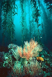 The Pacific has the most varied array of plants ( algae) and animals of the world's oceans. The circumglobal mixing of water in the southern and, to a much more limited extent, northern polar reaches of the Pacific permits the intermingling of flora and fauna from other oceanic regions, while temperate and tropical surface waters of the Pacific are more likely to have indigenous biotas. On the rocky cold-water coasts of North and South America, for example, are found vast forestlike kelp beds made up of brown algae of the genus Laminaria, with individual plants often reaching heights of 100 feet (30 metres) or more. They harbour a rich animal complement of invertebrates and fishes approaching a faunal variety that vies with that of tropical rainforests. Where upwelling and other current conditions add nutrients to the offshore surface waters of these same reaches of the Pacific, dense concentrations of plankton-feeding fishes thrive, predominantly those of the herring family and its relatives. Examples include the Japanese sardine and the Peruvian anchovy, both of which are among the largest single-species fishing catches in the world.
In the North Pacific the circulation patterns and runoff from the land create conditions in which demersal, or bottom-living, species abound. The North Pacific hake and the Alaska pollock are prominent examples. salmon likewise thrive in the North Pacific, proliferating there in five species of the genus Oncorhynchus, as compared with the single species, Salmo salar, of the Atlantic.
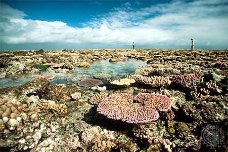
 In the warm tropical region—roughly between the North and South Equatorial Current systems—the wealth of marine animals especially increases dramatically. The variety of animal life is greater in the western Pacific, where the warm monsoonal climate and variegated landforms have promoted evolution of the unique Indo-Pacific marine forms. The western Pacific also has the richest and most extensive coral reefs (coral reef) of any ocean, with some six times more species of fish associated with them than with the coral reefs of the Caribbean Sea in the Atlantic. The tropical sea passages between the Pacific and the Indian oceans have also given the latter ocean a rich reef fauna; Indo-Pacific mollusks (mollusk) have reached copious evolutionary diversification, with the giant clam, Tridacna gigas, a spectacular example. Another example of the Pacific's richness in species is found among the tunas (tuna): six species (one of them endemic) roam the tropical reaches of the Pacific, furnishing more than half of the world's tuna catch.
Whales (whale) are a prominent and spectacular component of the Pacific marine biota. The habits of many species include regular long-distance migrations from cold-water feeding to warm-water breeding and calving grounds, thus predisposing them to global distribution.
Fisheries (commercial fishing)
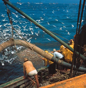 Because of the biological richness of certain reaches of the Pacific and because of the large human populations in many of the countries bordering it, the catches there are substantially larger than those in the other oceans and comprise the bulk of the total world catch. Among Pacific countries, Japan and Russia (Union of Soviet Socialist Republics) have the largest fisheries in the world as measured by tonnage caught, but China, the United States, Peru, Chile, South Korea (Korea, South), and Indonesia are also among the world's major fishing countries. The fishing industries in all of these countries are enormous, and all are based at least in part on fisheries in the Pacific. A number of species—including sardines, herring, anchovies, hake, pollock, and shrimp—have been fished in some areas up to, if not beyond, the limits of their sustainable yields.
 Salmon fisheries are important in the United States, Japan, Russia, and Canada, while the fishing quests for tuna have particular significance for the small island countries of the Pacific. The fishing for these species is done mostly by the technologically advanced vessels of Japan, the United States, South Korea, and Taiwan. Many of the tuna are found within the 200-nautical-mile (370-km) exclusive economic zones of the island countries, giving them the opportunity to exact fees for fishing rights and to develop tuna fisheries and processing facilities.
Increasing population pressure, along with economic and industrial development in several coastal regions of the Pacific, has led to overfishing and impairment of habitat for a number of coastal species. aquaculture is increasingly supplementing the natural supply. Shrimp, edible and pearl oysters, salmon, sea bream, mullet, and groupers are among the Pacific fauna that have been raised successfully.
In the tropical Pacific, prized corals (coral) have long been harvested from great depths. Pink coral species come mainly from the western Hawaiian atolls; black coral is also extracted from Hawaiian coral beds, from shallow seamounts, and from Malaysian and Indonesian waters.
Mineral resources
Minerals are extracted from the seawater itself, from offshore alluvial deposits, or from within the continental shelf and may be metallic or nonmetallic; hydrocarbon fuels are the most valuable among the latter. Also prominent in the Pacific are deepwater metallic mineral deposits of potential economic significance. Fresh water is also obtained from the ocean by various methods of desalination, as is done in Japan.
Minerals from seawater and alluvial deposits
Common salt (sodium chloride) is the most important mineral obtained directly from seawater. Mexico leads the Pacific countries in salt extraction from the sea, mostly by solar evaporation. bromine extracted from seawater is used in the food, dye, pharmaceutical, and photo industries. The United States and China lead in its production among Pacific riparian countries. Magnesium (magnesium processing), recovered by an electrolytic process, is used in industrial metal alloys, especially with aluminum; China has become the main site for its production.
Also important are the sand and gravel extracted from the shallow sea bottom. Japan has been a major Pacific producer, but Pacific countries in North America have also relied on offshore sand and gravel. Sand and gravel mining from the seabed is important in nearly all Pacific countries.
Large submarine deposits (placer deposit) of phosphate rock (phosphorite) are found in the Pacific off the coasts of Peru, eastern Australia, and California and on the Chatham Rise east of New Zealand. Smaller deposits also occur in lagoons of some of the Pacific Islands. Only a few of these phosphorite deposits are of economic significance.
Deep-sea minerals
Metal-bearing deposits on the deep-sea floor, consisting of nodules, crusts, and accumulations of metallic sulfides from deep vents, are of potential economic interest. In the 1970s and '80s it was hoped that mining the nodules—which contain quantities of manganese, iron, copper, nickel, titanium, and cobalt, as well as small traces of other metals—might be a way to contribute to the wealth of newly industrializing countries. Economic considerations and concern over management of mining operations, however, have slowed exploration and development of underwater mining technology.
Marine sulfide (sulfide mineral) ores, containing iron, copper, cobalt, zinc, and traces of other metallic elements, are deposited in large amounts by the actions of deepwater hydrothermal vents, such as occur in the Pacific off the Galapagos Islands and on the Juan de Fuca and Gorda ridges in the Okinawa Trough and in the Manus Basin off New Guinea.
Submarine hydrocarbons (hydrocarbon)
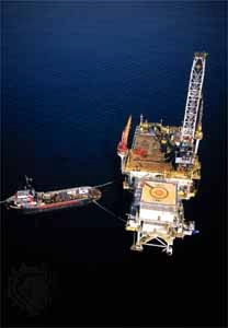 Deposits of petroleum and natural gas under the seafloor are the most valuable and sought-after fuels (fuel oil) of the contemporary world economy. Shallow seas and small ocean basins, such as the South and East China seas, have notable reserves, but exploitation of some deposits has been hindered by territorial disputes. Among the countries bordering the Pacific Ocean and its marginal seas, the proportion of production from submarine reserves varies widely, from less than half in Indonesia and Japan to nearly all in Australia and Malaysia.
The principal areas in the southwestern Pacific for offshore oil and gas exploration are in the South China Sea—the waters off Vietnam and off Hainan (Hai-nan) Island in China and on the continental shelf northwest of the island of Palawan in the Philippines—but they also include the area off Natuna Islands and some areas off the Sumatran coast in Indonesia. In the northwestern Pacific the main areas lie to the northwest of the island of Kyushu in Japan, in the southern portion of the Yellow Sea and in the Bo Hai (Gulf of Chihli), and in regions off Sakhalin Island and the Kamchatka Peninsula. Oil and gas wells have been drilled in the Bering Sea in the north and in areas off the coast of southern California in the eastern Pacific. In the southern Pacific, hydrocarbon production and exploration is taking place off northwestern and northern Australia and in the Gippsland Basin off southeast Australia.
Trade (international trade) and transportation
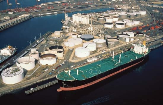 Since the mid-20th century there has been remarkable growth in trade between the western Pacific Rim—most notably China, Japan, South Korea, and Taiwan—and North America, particularly the United States. Trade has also expanded between North America and such Southeast Asian countries as Singapore, Thailand, Malaysia, the Philippines, and, to a lesser degree, Indonesia; in the western Pacific, trade has increased between Japan and South Korea in the north and between Australia and Southeast Asia in the south. In addition, trade patterns in the United States have shifted, with Pacific countries now accounting for a major portion of overall trade. In the United States, Los Angeles has surpassed New York City as the port with the country's largest trade volume in terms of value, and the nearby port of Long Beach has also become a major hub of international trade.
Thus, the Pacific Ocean supports some of the world's most important trade routes. Most of the exports moving from west to east and from north to south are high-value-added manufactured goods. Conversely, most of the exports moving from east to west and from south to north are raw materials and light manufactures.
Outside of the United States, Japan is the largest Pacific trading country, and the most important commodity flows in the Pacific are to and from Japan. Japanese imports, mostly raw materials, far exceed the country's exports in tonnage. Its exports—principally motor vehicles, machinery, and precision and electronic equipment—are distributed virtually worldwide, although the largest quantities go to the United States. Following closely behind Japan is China, whose trade has grown dramatically since the 1990s.
Among other trading countries of the Pacific, Australia and New Zealand are principally exporters of raw materials, while South Korea and Taiwan are highly dependent on trade and are also large importers of raw materials. The smaller island countries of the Pacific contribute only a minor fraction to overall Pacific trade, but most of them depend heavily on trade, particularly imports of such basic materials as foodstuffs and petroleum. Generally, the small islands are net importers rather than net exporters, with only Papua New Guinea exporting more than it imports.
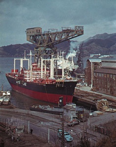 With the increased importance of the Pacific in worldwide trade has come a corresponding growth in the size of its transportation infrastructure. Japan, South Korea, China, and the Philippines rank high in ship ownership, and Japan, South Korea, and Taiwan are among the world's major shipbuilding countries. In addition to the ports of Los Angeles and Long Beach, the other major ports in the eastern Pacific are those in San Francisco Bay and in the Puget Sound region. In the western Pacific, Japan's ports in Tokyo and Ōsaka bays dominate trade; other major ports include Pusan in South Korea, Shanghai and Hong Kong in China, Kao-hsiung in Taiwan, and Sydney in Australia. Singapore, though on the fringe of the Pacific Ocean, dominates traffic to and from Southeast Asia and is the principal link between the Pacific and Indian oceans.
Environmental impact of human activity
The Pacific Ocean is able to absorb, dilute, and disperse large quantities of human-generated wastes, but the increasing pace of economic activity—particularly the transport of crude oil and other hazardous substances—has led to measurable levels of pollution in some nearshore waters, especially close to ports and large coastal cities. At the same time, the loads of pollutants in waters close to land have increased—primarily raw sewage, industrial waste products such as heavy metals, and river-borne fertilizers and pesticides. Thus, although the large expanse of open ocean in the Pacific has not been affected all that much, serious problems have arisen in some of the more confined bodies of water. In a number of instances, populations of commercially important fish and crustaceans have been depleted or made unfit for use by the pollution of confined waters.
Study and exploration
Early exploration and settlement
The Pacific Islands are thought to have been peopled by influxes from both mainland and archipelagic Southeast Asia. The earliest migrations (human migration) were to what is now generally referred to as Melanesia (Melanesian culture). From there generations of voyagers ranged northward into eastern Micronesia (Micronesian culture) and eastward into Polynesia (Polynesian culture). The peopling of Polynesia, by means of long-range seagoing voyages carried out in large, seaworthy sailing canoes, constitutes a remarkable feat of navigational skill. These appear to have begun between 3,000 and 4,000 years ago and to have lasted until about 1,000 years ago, when the Maori (a Polynesian people) settled New Zealand. The longest voyages of the Polynesians involved the settlement of Hawaii, first from the Marquesas Islands and later from Tahiti.
European exploration
Pacific islanders had long inhabited their homelands before the European “discovery” of the Pacific in the 16th century. European exploration can be divided into three phases: Spanish and Portuguese; Dutch; and English (British Empire) and French. The Spanish and Portuguese period began with the voyages in the early 1520s of Ferdinand Magellan (Magellan, Ferdinand) and, after his death, his crew members. Later discoveries included the Solomon Islands, the Marquesas, and possibly New Guinea, all by the Spaniard Álvaro de Mendaña de Neira; Vanuatu by the Portuguese Pedro Fernándes de Quirós; and the Torres Strait by the Spaniard Luis Váez de Torres.
During the Dutch period—roughly the 17th century—Jakob Le Maire and Willem Corneliszoon Schouten (Schouten, Willem) discovered inhabited islands in the northern Tuamotu Archipelago, as well as islands in the Tonga group and Alofi and Futuna (Horne Islands) islands. The best-known of the Dutch explorers, Abel Janszoon Tasman (Tasman, Abel Janszoon), visited islands in the Tonga group and discovered New Zealand, the northeastern sector of the Fiji group, and islands in the Bismarck Archipelago.
Exploration and discovery in the Pacific in the 18th century were undertaken most actively by the British and the French. Four Englishmen—John Byron (Byron, John), Samuel Wallis, Philip Carteret, and James Cook (Cook, James)—and the Frenchman Louis-Antoine de Bougainville (Bougainville, Louis-Antoine de) were preeminent. Byron explored the northern Marianas (Mariana Islands) and discovered islands in the Tuamotu, Cook (Cook Islands), and Tokelau archipelagoes. Wallis discovered islands in the Tahiti group, while Carteret sighted Pitcairn Island and explored vast areas of the southern Pacific. Bougainville sailed to Tahiti, Samoa, Vanuatu, New Guinea, and the Solomons.
The three voyages of Capt. James Cook (Cook, James) in the second half of the 18th century marked the pinnacle of European exploration of the Pacific. On his first voyage (1768–71), to Tahiti, Cook discovered Raiatea, Vaitoare (Tahaa), Huahine, and Bora-Bora and surveyed the coasts of New Zealand and the east coast of Australia. On his second voyage (1772–75) he sailed south of 70° S, charted Tonga and Easter Island, and discovered New Caledonia. His third voyage (1776–79) included exploration of the North Pacific and the Bering Strait, but he was killed in 1779 in the Hawaiian Islands, which he had discovered earlier in the voyage. Cook's voyages left little land to be discovered in the Pacific, and his maps and charts were so accurate that many have not been substantially revised. The remaining island groups and larger landmasses were mapped in the 19th century.
In 1831–36 the English naturalist Charles Darwin (Darwin, Charles) sailed to South America and then around the world on the British naval vessel Beagle, a voyage on which he collected the information that he later would use in his writings. Growing interest in the physical and biological properties of the ocean paved the way for the great oceanographic voyages made later in the century. The best-known of these took place in the 1870s, initiated by the British Challenger Expedition, followed by the voyage of the USS Tuscarora in the northern Pacific and that of the German research vessel Gazelle.
Exploration in the 20th century
Among the most important 20th-century expeditions to the Pacific were those of the American ship Carnegie (1928–29), the Danish vessel Dana II (1928–30), the Swedish ship Albatross (1947–48), and the Danish ship Galathea (1950–52). In the late 1950s the Soviet vessel Vityaz carried out detailed soundings (International Geophysical Year) of the deep trenches of the western Pacific, and in 1960 the American bathyscaphe Trieste descended to the bottom of the Mariana Trench.
Since the mid-20th century, lengthy exploratory cruises have become unnecessary. Instead, numerous shorter expeditions have been highly effective, aided by advances in instrumentation and knowledge of the basic characteristics of the ocean (oceanography). In addition, satellites carrying remote-sensing equipment have made it possible to determine with great accuracy the surface characteristics of the Pacific.
Beginning in the late 1960s, the Deep Sea Drilling Project and its successors, the Ocean Drilling Program and the Integrated Ocean Drilling Program, also have advanced geoscientific exploration in the Pacific. Technological developments have yielded the discovery of manganese nodules and other potentially valuable bottom resources, and knowledge of undersea volcanism, as well as of marine life near active vents associated with centres of tectonic activity, has been greatly expanded.
Much of the more recent oceanographic exploration in the Pacific and elsewhere has been for economic reasons, particularly for the recovery of offshore hydrocarbons in relatively shallow waters, but technology has made possible exploration and exploitation in increasingly deeper waters. Deepwater oil-drilling technology has also been employed to shed much light on the nature of the Earth's crust and the underlying mantle.
Additional Reading
General works
Comprehensive summaries of information about the Pacific Ocean and its seas are found in Alastair Couper (ed.), The Times Atlas and Encyclopaedia of the Sea, 2nd ed. (1989), with excellent maps and text covering the ocean environment, resources, ocean trade, strategic use of the seas, law of the sea, problems of pollution, and scientific research; and Martyn Bramwell (ed.), The Rand McNally Atlas of the Oceans (1977, reprinted 1987), with specific sections on bathymetry, structural geology, reefs and islands circulation, mineral resources, and living resources. See also M. Grant Gross, Oceanography, a View of the Earth, 5th ed. (1990), offering topical rather than regional coverage, but with numerous examples based on the Pacific Ocean; Rhodes W. Fairbridge (ed.), The Encyclopedia of Oceanography (1966), with articles on the Pacific and its seas; and the articles pertaining to the Pacific in the periodical Oceanus (quarterly), particularly vol. 32, no. 4 (Winter 1989/90), which is devoted to the Pacific.
Physical environment
Otis W. Freeman, Geography of the Pacific (1951), surveys the physical features of the ocean; and Alan E.M. Nairn and Francis G. Stehli (eds.), The Ocean Basins and Margins, vol. 7, The Pacific Ocean, 2 vol. (1985–88), is comprehensive and highly detailed. Zvi Ben-Avraham (ed.), The Evolution of the Pacific Ocean Margins (1989); and H.W. Menard, Marine Geology of the Pacific (1964), explore marine geology and geophysics. See also Bruno Wauthy, Physical Ocean Environment in the South Pacific Commission Area (1986), a short but valuable summary of the oceanography of the central and South Pacific, prepared as a regional report under the United Nations Environment Programme.
Economic aspects
A detailed review of Pacific Ocean minerals, including those contained in seawater and those on or beneath the ocean floor, is offered in G.P. Glasby, “Marine Minerals in the Pacific,” Oceanography and Marine Biology 24:1–64 (1986). Information on economic and other resources of the ocean areas is also found in such works as Asia & Oceania, vol. 4 of the Worldmark Encyclopedia of the Nations, 7th ed., 5 vol. (1988); Fillmore C.F. Earney, Marine Mineral Resources (1990); and FAO Yearbook: Fishery Statistics. John P. Craven, The Management of Pacific Marine Resources (1982), offers well-written, scholarly coverage of resources and their management, or in some cases mismanagement; details on fisheries, shipping, scientific research, and maritime law are given in Edward Miles et al., The Management of Marine Regions: The North Pacific (1982); and Peter N. Nemetz (ed.), The Pacific Rim (1987), studies commerce, economic conditions, foreign investments, and resources in the Pacific Rim countries. Another valuable overview of economic conditions, international business enterprises, marine resources, and regionalism is Endel-Jacob Kolde, The Pacific Quest: The Concept and Scope of an Oceanic Community (1976); and Henry S. Albinski et al., The South Pacific (1989), studies the “New Pacific” and the economic, political, and social problems of island nations that have achieved independence since World War II.
Study and exploration
Andrew Sharp, The Discovery of the Pacific Islands (1960, reprinted 1985), summarizes the work of 121 explorers of the area and their contributions to charting the Pacific. J.C. Beaglehole, The Exploration of the Pacific, 3rd ed. (1966), and The Life of Captain James Cook (1974), are classics on the subject. Ernest S. Dodge, Beyond the Capes: Pacific Exploration from Captain Cook to the Challenger, 1776–1877 (1971), provides a thorough coverage of this important period.
- dybbuk
- Dyce, Alexander
- Dyce, William
- Dyckia
- dye
- Dyer-Bennet, Richard
- Dyer, Jack
- Dyer, John
- Dyer, Mary Barrett
- Dyer, Reginald Edward Harry
- Dyer, Sir Edward
- Dyer, Sir James
- dye-transfer process
- Dygasiński, Adolf
- Dylan, Bob
- Dylan Thomas
- dynamical time
- dynamics
- dynamite
- dynamometer
- dynamo theory
- dyne
- Dyott, Thomas W.
- dysentery
- dyslexia