Arnhem Land
region, Northern Territory, Australia
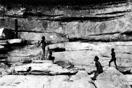 historical region of Northern Territory, (Northern Territory) Australia. It consists of the eastern half of the large peninsula that forms the northernmost portion of the Northern Territory. The region, with a total area of about 37,000 square miles (95,900 square km), consists of a ruggedly dissected plateau and associated lowlands lying between the Roper and Alligator rivers. The coast of Arnhem Land extends from Van Diemen Gulf and the Cobourg Peninsula eastward to Gove Peninsula, the Gulf of Carpentaria, and Groote Eylandt. The climate is tropical. The name Arnhem Land is now used primarily for the large Aboriginal (Australian Aborigine) reserve in the area. It has been occupied by Aborigines since the late Pleistocene, and there are rock carvings at many sites. The northeast coast was visited in 1623 by the Dutch explorer Willem van Colster in his ship, Arnhem (Aernem). Since World War II bauxite and uranium mining have become important in the area. Kakadu National Park borders Arnhem Land on the west.
- Saint Alexander I
- Saint Alexander Nevsky
- Saint Alexis
- Saint Alfonso Maria de' Liguori
- Saint Aloysius Gonzaga
- Saint-Amand-les-Eaux
- Saint-Amand-les-Eaux ware
- Saint-Amand-Montrond
- Saint-Amant, Marc-Antoine Girard, sieur de
- Saint Ambrose
- Saint Anacletus
- Saint Anastasius I
- Saint Anastasius Sinaita
- Saint Andrew
- Saint Andrew of Crete
- Saint Andrews
- Saint-Andrew's-cross
- Saint Andrews, University of
- Saint Andrey Rublyov
- Saint-André, André Jeanbon
- Saint-André, Jacques d'Albon, seigneur de
- Saint Angela Merici
- Saint Anicetus
- Saint Anno
- Saint Anns Bay