Hidalgo
county, New Mexico, United States
county, southwestern New Mexico, U.S.; it is bordered by Arizona on the west and Mexico on the south and east. The county's northwestern area, featuring alkali flats and crossed by the Gila River, lies in the Colorado Plateau. The remainder is in the Mexican Highland section of the Basin and Range Province, featuring plains frequently interrupted by scrub-covered hills and mountain ranges. The Peloncillo, Animas, Alamo Hueco, Pyramid, San Luis, Whitewater, and Big and Little Hatchet ranges are all within the county's borders; the highest mountain, Animas Peak, rises to 8,532 feet (2,600 m). Canyons and dry creek beds mark the locations where waters once spilled down mountainsides into the valleys. The Coronado and Gila national forests are within Hidalgo county, and the Continental Divide crosses it.
The U.S. Army's Mormon Battalion marched through the area in 1846 during the Mexican War. Indigenous Apache Indians, led by the chiefs Mangas Coloradas and Cochise, fought white settlers from 1861 to 1874. After silver was discovered in the Pyramids in 1870, Shakespeare became a thriving town. Though depressions in 1875 and 1893 brought lapses in mining activity, silver mining thrived again there from 1908 to 1932. The county was established in 1919.
Agriculture (livestock, cotton, chiles) is a leading element in Hidalgo county's economy, as is the refining of copper. Lordsburg is the county seat. Area 3,446 square miles (8,925 square km). Pop. (2000) 5,932; (2007 est.) 4,945.
state, Mexico
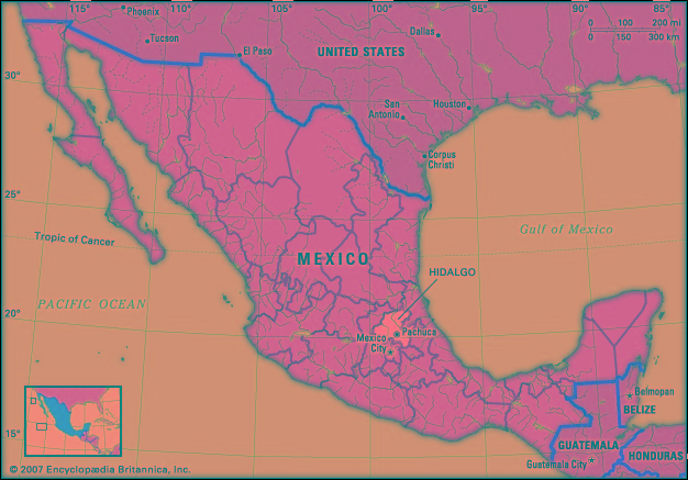 estado (state), east-central Mexico. It is bounded by the states of San Luis Potosí to the north, Veracruz to the north and northeast, Puebla to the east, Tlaxcala and México to the south, and Querétaro to the west. The state capital and largest city is Pachuca (Pachuca de Soto).
Northern and eastern Hidalgo rise from the Mesa Central to the Sierra Madre Oriental amid some of the most precipitous relief in Mexico, with peaks reaching 10,000 feet (3,000 metres). In the south and west the slopes generally yield to a cool, semiarid tableland. The varied climate facilitates production of crops, including corn (maize), alfalfa, sugarcane, beans, barley, fruits, coffee, tobacco, and maguey (agave), used in making the alcoholic beverage pulque. Cattle and sheep are raised. Hidalgo contains extensive deposits of silver, gold, lead, mercury, copper, and opals. On the flanks of the Sierra Madre are Lake Metztitlán and the Tulancingo River valley, a centre of textile industries. Motor vehicles, cement, metal products, and processed foods and beverages are also manufactured. Major highways link Tulancingo, Pachuca, and many smaller towns with Mexico City.
The ruins of Tula, near the modern settlement of the same name, are believed to be those of the Toltec capital, which benefited from obsidian mining in the region. Hidalgo was part of the state of México until 1869, when it was established as a separate state named in honour of the revolutionary patriot Miguel Hidalgo y Costilla (Hidalgo y Costilla, Miguel). State government is headed by a governor, who is elected to a single term of six years. Members of the unicameral legislature, the State Congress, are elected to three-year terms. The state is divided into local governmental units called municipios (municipalities), each of which is headquartered in a prominent city, town, or village.
Although Hidalgo is somewhat densely populated, about half of the people live in rural agricultural areas, including many members of indigenous groups, such as the Otomí. About one-sixth of residents speak an indigenous language. Among the state's cultural institutions are the Regional Museum of Actopán (founded in 1933), with displays relating to the Otomí Indians; and the Autonomous University of Hidalgo (founded 1869 as the Scientific and Literary Institution; present status, 1961). Area 8,036 square miles (20,813 square km). Pop. (2000) 2,235,591; (2005) 2,345,514.
- Eucken, Rudolf Christoph
- Eucla Basin
- Euclid
- Euclidean algorithm
- Euclidean geometry
- Euclides da Cunha
- Euclid's axioms and common notions
- Eucommiaceae
- Eucratides
- eucrite
- Eucryphia
- Eucumbene, Lake
- eudaemonism
- Eudemus Of Rhodes
- Eudes
- Eudes, Saint John
- Eudocia
- Eudocia Macrembolitissa
- Eudora Welty
- Eudoxia
- Eudoxus of Cnidus
- Eudoxus Of Cyzicus
- Eufaula
- Eugen Bleuler
- Eugen d' Albert