Libyan Desert
desert, North Africa
Arabic Aṣ-ṣaḥrāʾ Al-lībīyah,
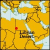 northeastern portion of the Sahara, extending from eastern Libya through southwestern Egypt into the extreme northwest of The Sudan. The desert's bare rocky plateaus and stony or sandy plains are harsh, arid, and inhospitable. The highest point is Mount Al-ʿUwaynāt (6,345 feet 【1,934m】), located where the three countries meet; the Qattara Depression (Munkhafaḍ al-Qaṭṭārah) of Egypt descends to 436 feet (133 m) below sea level. The very few inhabitants are mainly concentrated in the Egyptian oases of Siwa, Al-Baḥrīyah, Al-Farāfirah, Ad-Dākhilah, and Al-Khārijah and the Libyan oasis of Al-Kufrah. The Egyptian part, known as the Western Desert (Aṣ-Ṣaḥrāʾ al-Gharbīyah), was a critical area of operations in World War II.
- point-to-point
- Poiret, Jean
- Poiret, Paul
- Poiseuille, Jean-Louis-Marie
- poison
- poison frog
- poison hemlock
- poison ivy
- Poisons, Affair of the
- Poisson distribution
- Poisson, Siméon-Denis
- Poisson's spot
- Adolphe Max
- Adolphe Monticelli
- Adolphe Niel
- Adolphe Nourrit
- Adolphe Quetelet
- Adolphe Thiers
- Adolphe-Théodore Brongniart
- Adolphe-Théodore Monod
- Adolph Gottlieb
- Adolph Rupp
- Adolph Simon Ochs
- Adolphus Busch
- Adolphus Frederick, 1st Duke of Cambridge